14.4 km
~3 hrs 47 min
548 m
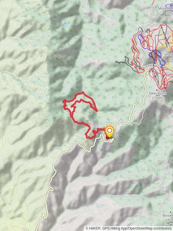
“Embark on the scenic Sinker Creek and Stack Rock Loop, a 14 km journey rich in natural beauty and history.”
Starting your adventure near Boise County, Idaho, the Sinker Creek and Stack Rock Loop offers a rewarding 14 km (8.7 miles) journey with an elevation gain of approximately 500 meters (1,640 feet). This loop trail is rated as medium difficulty, making it suitable for moderately experienced hikers.
### Getting There To reach the trailhead, you can drive from Boise, Idaho. Head north on Bogus Basin Road for about 16 miles (25.7 km) until you reach the trailhead parking area. Public transport options are limited, so driving is the most convenient way to get there. The nearest significant landmark is the Bogus Basin Mountain Recreation Area.
### Trail Overview The trail begins with a gentle ascent through a mixed forest of pine and fir trees. As you progress, the path becomes steeper, offering glimpses of the surrounding Boise National Forest. After about 3 km (1.9 miles), you'll reach a fork; take the left path to continue towards Stack Rock.
### Stack Rock Stack Rock, a prominent granite formation, is one of the main highlights of this loop. Located approximately 5 km (3.1 miles) from the trailhead, this natural landmark offers panoramic views of the Treasure Valley and the distant Owyhee Mountains. The elevation gain to this point is around 300 meters (984 feet), making it a great spot for a rest and some photography.
### Wildlife and Flora As you hike, keep an eye out for local wildlife such as mule deer, elk, and various bird species including hawks and woodpeckers. The flora is equally diverse, with wildflowers like lupine and Indian paintbrush adding splashes of color during the spring and summer months.
### Sinker Creek Continuing from Stack Rock, the trail descends towards Sinker Creek. This section is about 4 km (2.5 miles) long and features a mix of shaded forest and open meadows. The creek itself is a serene spot, perfect for a quick break. The elevation loss here is around 200 meters (656 feet), making the descent relatively gentle.
### Historical Significance The area around Sinker Creek has a rich history, with evidence of Native American presence and early settlers who used the creek as a water source. The trail also passes by remnants of old logging roads, offering a glimpse into the region's past.
### Final Stretch The last 3 km (1.9 miles) of the loop take you back through a series of switchbacks and gentle slopes, eventually leading you back to the trailhead. This section offers more open views and is a great place to spot late-afternoon wildlife.
### Navigation For navigation, it's highly recommended to use the HiiKER app, which provides detailed maps and real-time updates to ensure you stay on track.
Prepare adequately with water, snacks, and appropriate clothing, as weather conditions can change rapidly. Enjoy your hike on the Sinker Creek and Stack Rock Loop, a trail that offers a perfect blend of natural beauty, wildlife, and historical intrigue.
Reviews
User comments, reviews and discussions about the Sinker Creek and Stack Rock Loop, Idaho.
0.0
average rating out of 5
0 rating(s)


