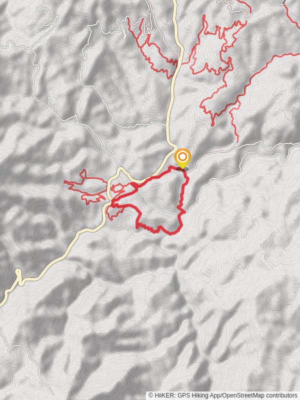
Beaver Creek, Lamar Creek and Valley Loop Trail
8.0 km
~2 hrs 7 min
321 m
“Embark on a moderately challenging 8 km hike through Idaho's diverse landscapes, historic sites, and vibrant wildlife.”
Starting near Boise County, Idaho, the Beaver Creek, Lamar Creek, and Valley Loop Trail offers an 8 km (approximately 5 miles) journey through diverse landscapes with an elevation gain of around 300 meters (about 984 feet). This loop trail is rated as medium difficulty, making it suitable for moderately experienced hikers.
### Getting There To reach the trailhead, you can drive from Boise, Idaho. Head north on ID-21 N for about 40 miles until you reach the turnoff near the Beaver Creek Summit. Public transport options are limited, so driving is the most reliable way to get there. The nearest significant landmark is the Beaver Creek Summit, which serves as a good reference point for navigation.
### Trail Overview The trail begins with a gentle ascent through a dense forest of pine and fir trees. After about 1.5 km (0.9 miles), you'll reach the first significant landmark, Beaver Creek. This creek is a great spot to take a short break and enjoy the serene environment. The trail then follows the creek for another 2 km (1.2 miles), offering picturesque views of the flowing water and occasional sightings of local wildlife such as deer and various bird species.
### Elevation Gain and Terrain As you continue, the trail starts to climb more steeply, gaining approximately 150 meters (492 feet) over the next 2 km (1.2 miles). This section can be challenging, so be prepared with proper hiking boots and trekking poles if needed. The terrain here is rocky and uneven, so watch your footing.
### Lamar Creek and Valley Views Around the 5 km (3.1 miles) mark, you'll reach Lamar Creek. This area is particularly beautiful in the spring and early summer when wildflowers are in full bloom. The trail then loops around the valley, offering expansive views of the surrounding mountains and valleys. This is a great spot for photography, so don't forget your camera.
### Historical Significance The region around Boise County has a rich history, particularly related to the Gold Rush era in the mid-1800s. As you hike, you may come across remnants of old mining operations and historical markers that provide insight into the area's past. These markers are usually found near the 6 km (3.7 miles) point of the trail.
### Wildlife and Flora The trail is home to a variety of wildlife, including elk, black bears, and numerous bird species. Keep an eye out for these animals, but also be cautious and maintain a safe distance. The flora is equally diverse, with pine, fir, and aspen trees dominating the landscape. In the spring, the trail is adorned with wildflowers like lupines and Indian paintbrush.
### Final Stretch The last 2 km (1.2 miles) of the trail descend gradually back to the trailhead. This section is less strenuous and offers a pleasant end to your hike. You'll pass through a mixed forest and open meadows, providing a nice variety of scenery.
### Navigation For navigation, it's highly recommended to use the HiiKER app, which provides detailed maps and real-time updates. This will help you stay on track and ensure a safe and enjoyable hike.
This trail offers a well-rounded experience with its mix of natural beauty, historical significance, and moderate challenge. Whether you're a local or visiting from afar, the Beaver Creek, Lamar Creek, and Valley Loop Trail is a rewarding adventure.
Reviews
User comments, reviews and discussions about the Beaver Creek, Lamar Creek and Valley Loop Trail, Idaho.
5.0
average rating out of 5
54 rating(s)


