164.8 km
~7 day
2326 m
“Embark on an epic 102-mile Greenlandic trek, braving Arctic wilderness, diverse landscapes, and rich history.”
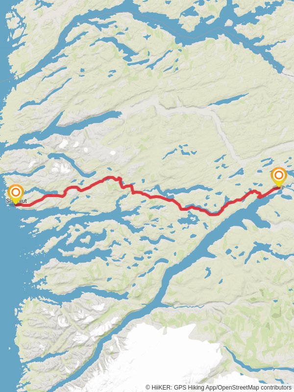
Spanning approximately 165 kilometers (around 102 miles) with an elevation gain of around 2300 meters (approximately 7546 feet), the Arctic Circle Trail is a remarkable point-to-point trek situated near Qeqqata in Greenland. This trail offers an immersive experience into the Arctic wilderness, connecting the small town of Kangerlussuaq with the coastal village of Sisimiut.
Getting to the Trailhead
To embark on this adventure, most hikers arrive at Kangerlussuaq Airport, which is accessible via flights from Nuuk, Greenland's capital, or from Copenhagen, Denmark. From the airport, the trailhead is just a short distance away, and can be reached by foot, making it one of the few trails where you can walk directly from an airport to the wilderness.
Navigating the Trail
Hikers can rely on HiiKER to navigate the trail, as it provides detailed maps and waypoints that are essential for a successful journey. The trail is marked by cairns and painted stones, but due to the remoteness and potential for harsh weather conditions, having a reliable navigation tool like HiiKER is crucial.
Landmarks and Terrain
The Arctic Circle Trail winds through a diverse landscape of tundra, moraines, and small woodlands. It crosses numerous rivers and streams, which can range from small brooks to wide, challenging crossings. Notable landmarks include the Russell Glacier, an impressive ice formation that offers a stunning backdrop for hikers. The trail also passes by numerous lakes, including the pristine Lake Amitsorsuaq, where hikers can take a break to fish or simply enjoy the tranquility.
Wildlife and Nature
The region is home to a variety of Arctic wildlife, including reindeer, Arctic foxes, and a plethora of bird species. Hikers should be aware of the potential to encounter musk oxen, which are generally peaceful but can be dangerous if provoked. The flora along the trail is equally fascinating, with hardy species adapted to the Arctic climate.
Historical Significance
The area around the Arctic Circle Trail is steeped in history. The Inuit have inhabited Greenland for thousands of years, and their culture is deeply connected to the land. Along the trail, hikers may come across historical sites such as old Inuit hunting cabins and ancient tools, providing a glimpse into the traditional ways of life.
Preparation and Planning
Given the trail's medium difficulty rating, hikers should be well-prepared with appropriate gear for cold and unpredictable weather. It's essential to carry a good quality tent, sleeping bag rated for Arctic temperatures, and a reliable stove. Food supplies for the entire trek need to be carried, as there are no shops along the route. It's also important to plan for self-sufficiency in terms of safety and first aid.
Seasonal Considerations
The best time to hike the Arctic Circle Trail is from June to September when the weather is milder, and the days are long. However, even during these months, hikers should be prepared for sudden weather changes and potentially encountering snow or ice on the trail.
Conclusion
The Arctic Circle Trail is a journey through one of the world's last great wildernesses. It offers solitude, breathtaking landscapes, and a deep connection with nature. With careful planning, respect for the environment, and a spirit of adventure, hikers will find this trail to be a truly unforgettable experience.
Reviews
User comments, reviews and discussions about the Arctic Circle Trail, Greenland.
5.0
average rating out of 5
6 rating(s)


