11.4 km
~2 hrs 31 min
151 m
“Explore the scenic Rotzenhahner Rundwanderweg Loop, a medium-difficulty 11 km hike with historical landmarks and panoramic views.”
Starting near Westerwaldkreis, Germany, the Rotzenhahner Rundwanderweg Loop is a delightful 11 km (approximately 6.8 miles) trail with an elevation gain of around 100 meters (328 feet). This loop trail is rated as medium difficulty, making it suitable for moderately experienced hikers.
### Getting There To reach the trailhead, you can drive or use public transport. If driving, set your GPS to Westerwaldkreis, and look for parking near the village of Rotzenhahn. For those using public transport, take a train to Montabaur, which is the nearest major station. From Montabaur, you can catch a local bus to Rotzenhahn. The bus schedules are generally reliable, but it's always a good idea to check the latest timings.
### Trail Navigation For navigation, the HiiKER app is highly recommended. It provides detailed maps and real-time updates, ensuring you stay on the right path throughout your hike.
### Trail Highlights The trail begins with a gentle ascent through mixed forests, offering a serene start to your journey. After about 2 km (1.2 miles), you'll come across the first significant landmark, the Rotzenhahner Aussichtspunkt. This viewpoint offers panoramic views of the Westerwald region, making it a perfect spot for a short break and some photographs.
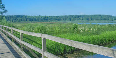
### Flora and Fauna As you continue, the trail meanders through lush meadows and dense woodlands. The area is rich in biodiversity, so keep an eye out for local wildlife such as deer, foxes, and a variety of bird species. The flora is equally impressive, with seasonal wildflowers adding a splash of color to the landscape.
### Historical Significance Around the 5 km (3.1 miles) mark, you'll encounter the remnants of an old Roman road. This ancient pathway is a testament to the region's historical significance, dating back to the Roman Empire. Informational plaques along the trail provide insights into the history and importance of this route.
### Midway Point At approximately 6 km (3.7 miles), you'll reach a small village named Oberrod. Here, you can find a quaint café that serves traditional German pastries and coffee. It's an excellent place to rest and refuel before continuing your hike.
### Final Stretch The last 5 km (3.1 miles) of the trail take you through more forested areas and open fields. The terrain is relatively flat, making for a leisurely end to your hike. As you approach the trailhead, you'll pass by a small stream, which is a lovely spot to cool off and relax.
### Safety and Preparation Given the moderate difficulty of the trail, it's advisable to wear sturdy hiking boots and bring plenty of water. The trail is well-marked, but having the HiiKER app will provide additional peace of mind. Weather in the Westerwald region can be unpredictable, so pack a light rain jacket and check the forecast before heading out.
This trail offers a balanced mix of natural beauty, historical landmarks, and moderate physical challenge, making it a rewarding experience for any hiker.
Reviews
User comments, reviews and discussions about the Rotzenhahner Rundwanderweg Loop, Germany.
5.0
average rating out of 5
4 rating(s)


