10.8 km
~2 hrs 21 min
120 m
“The Hoehner Acht - Seerunde trail offers an 11 km loop through serene forests and historical landmarks in Westerwald.”
Starting near Westerwaldkreis, Germany, the Hoehner Acht - Seerunde trail is a delightful 11 km (approximately 6.8 miles) loop that offers a moderate challenge with an elevation gain of around 100 meters (328 feet). This trail is perfect for those looking to immerse themselves in the serene beauty of the Westerwald region.
### Getting There To reach the trailhead, you can drive or use public transport. If you're driving, set your GPS to the nearest significant landmark, which is the town of Westerburg. From there, follow local signage to the trailhead. For those using public transport, take a train to Westerburg Station. From the station, local buses or a short taxi ride will get you to the starting point.
### Trail Navigation For navigation, it's highly recommended to use the HiiKER app, which provides detailed maps and real-time updates. The trail is well-marked, but having a reliable navigation tool will enhance your experience.
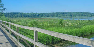
### Trail Highlights The trail begins with a gentle ascent, allowing you to warm up as you make your way through lush forests. Around the 2 km (1.2 miles) mark, you'll encounter the first significant landmark, the Secker Weiher, a picturesque lake that offers a perfect spot for a short break. The lake is surrounded by dense woodland, providing a tranquil setting to enjoy the natural beauty.
### Flora and Fauna As you continue, the trail meanders through mixed forests of beech, oak, and pine. Keep an eye out for local wildlife, including deer, foxes, and a variety of bird species. The area is particularly known for its vibrant birdlife, so bringing a pair of binoculars could be rewarding.
### Historical Significance Around the 5 km (3.1 miles) mark, you'll come across remnants of historical significance. The region has a rich history dating back to medieval times, and you may find old stone markers and ruins that hint at its past. The Westerwald area was historically significant for its pottery and mining industries, and some of these old sites can still be seen along the trail.
### Midpoint and Elevation The midpoint of the trail offers a slight elevation gain, reaching the highest point at around 6 km (3.7 miles). Here, you'll be rewarded with panoramic views of the surrounding countryside. This is an excellent spot for a picnic, so consider packing a light meal to enjoy while taking in the scenery.
### Final Stretch The descent begins around the 8 km (5 miles) mark, leading you back through dense forests and open meadows. The trail loops back towards the starting point, offering a different perspective of the landscape you traversed earlier. The final stretch is relatively flat, making for a comfortable end to your hike.
### Practical Tips - Wear sturdy hiking boots, as the trail can be uneven in places. - Bring sufficient water and snacks, especially if you plan to take breaks along the way. - Check the weather forecast before heading out, as conditions can change rapidly. - Use the HiiKER app for real-time navigation and updates.
This trail offers a perfect blend of natural beauty, historical intrigue, and moderate physical challenge, making it a must-visit for any hiking enthusiast exploring the Westerwald region.
Reviews
User comments, reviews and discussions about the Hoehner Acht - Seerunde, Germany.
0.0
average rating out of 5
0 rating(s)


