
Download
3D Flyover
Add to list
More
13.8 km
~3 hrs 17 min
322 m
Loop
“Explore Vulkaneifel's stunning landscapes and historical trails on a 14 km Hochkelberg loop, perfect for seasoned hikers.”
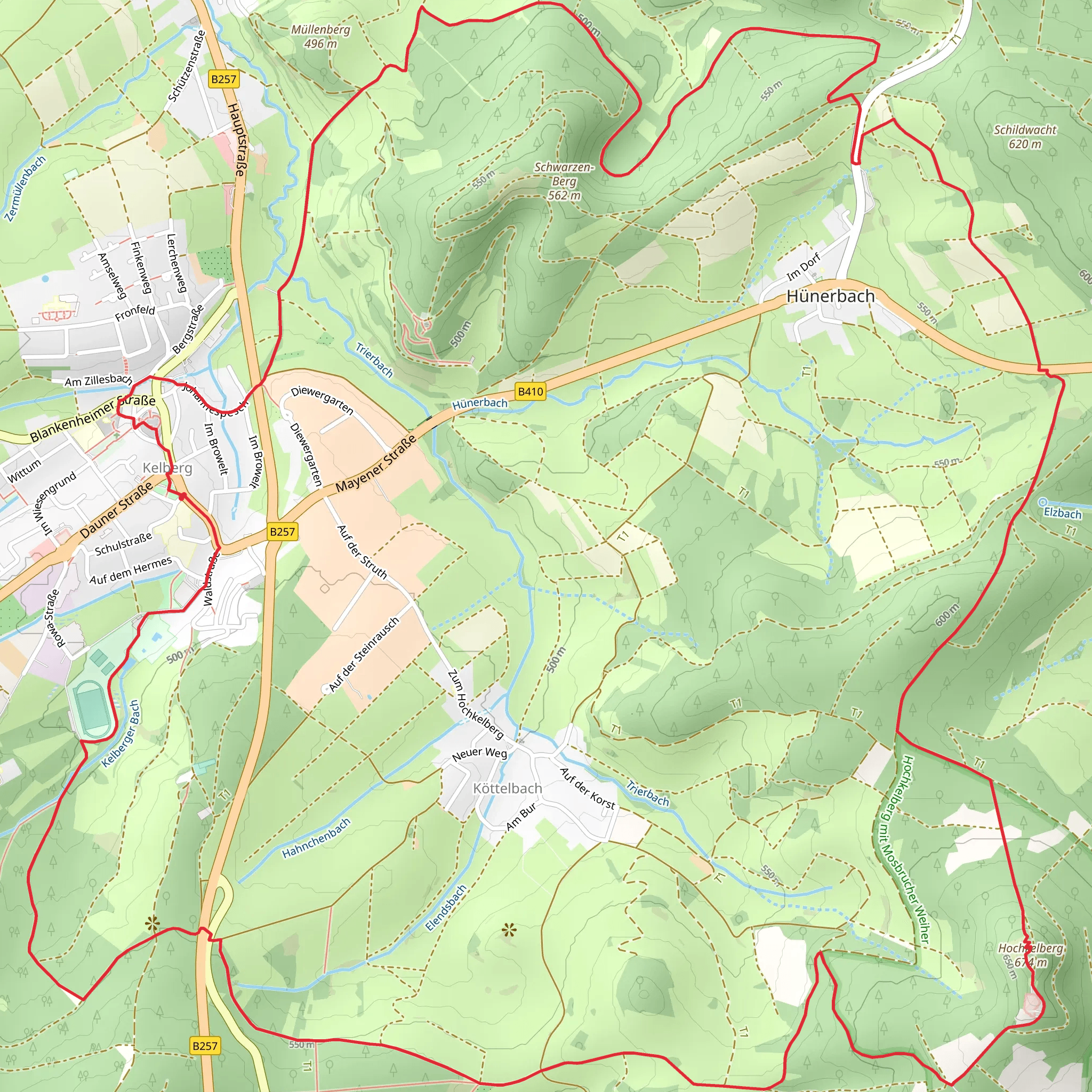
Starting your adventure near Vulkaneifel, Germany, the Hochkelberg via Ville Eifel Weg is a captivating loop trail that spans approximately 14 kilometers (around 8.7 miles) with an elevation gain of about 300 meters (approximately 984 feet). This trail offers a medium difficulty rating, making it suitable for moderately experienced hikers.
Getting There
To reach the trailhead, you can either drive or use public transport. If driving, set your GPS to the Vulkaneifel region, specifically near the town of Kelberg. For those using public transport, take a train to the nearest major station, which is Gerolstein. From Gerolstein, you can catch a local bus to Kelberg. The trailhead is conveniently located near the town center, making it easily accessible.
Trail Highlights
As you embark on this loop trail, you'll be greeted by the lush landscapes of the Vulkaneifel region, known for its volcanic origins. The trail meanders through dense forests, open meadows, and past serene lakes, offering a diverse range of scenery.
Hochkelberg Summit
One of the most significant landmarks on this trail is the Hochkelberg summit. Standing at 674 meters (2,211 feet), it provides panoramic views of the surrounding Eifel region. The ascent to the summit is gradual but steady, making it a rewarding challenge for hikers. Once at the top, take a moment to enjoy the breathtaking vistas and perhaps snap a few photos.
Flora and Fauna
The Vulkaneifel region is rich in biodiversity. As you hike, keep an eye out for various species of birds, deer, and even wild boar. The forests are home to a variety of trees, including beech, oak, and pine, which provide ample shade and a cool respite during warmer months.
Historical Significance
The Vulkaneifel region is steeped in history, with its volcanic origins dating back millions of years. The trail itself passes by several ancient volcanic craters, now transformed into tranquil lakes. These natural formations are a testament to the region's fiery past and offer a unique glimpse into the geological history of the area.
Ville Eifel Weg
The Ville Eifel Weg is part of a larger network of trails that crisscross the Eifel region. Historically, these paths were used by local villagers for trade and travel. Today, they serve as a reminder of the region's rich cultural heritage and provide a well-maintained route for modern-day hikers.
Navigation and Safety
To ensure you stay on track, it's highly recommended to use the HiiKER app for navigation. The trail is well-marked, but having a reliable navigation tool can help you stay oriented, especially in the denser forest sections. Always carry enough water, snacks, and a basic first aid kit. Weather in the Eifel region can be unpredictable, so pack a rain jacket and wear sturdy hiking boots.
Final Stretch
As you complete the loop and make your way back to the trailhead, you'll pass through picturesque villages and rolling hills. The final stretch is relatively flat, allowing you to cool down and reflect on the natural beauty and historical richness you've experienced.
This trail offers a perfect blend of natural beauty, historical intrigue, and moderate physical challenge, making it a must-visit for any hiking enthusiast exploring the Vulkaneifel region.
What to expect?
Activity types
Comments and Reviews
User comments, reviews and discussions about the Hochkelberg via Ville Eifel Weg, Germany.
5.0
average rating out of 5
2 rating(s)

