Beerheide, Rothelstein and Hohengrun Loop via Rothelsteinweg
7.0 km
~1 hrs 36 min
116 m
“This 7 km loop through Vogtlandkreis blends lush forests, historic landmarks, and panoramic views for a rewarding hike.”
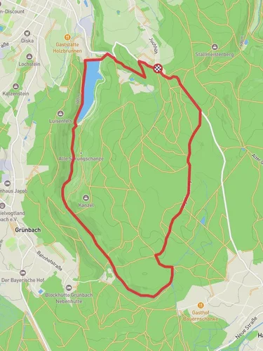
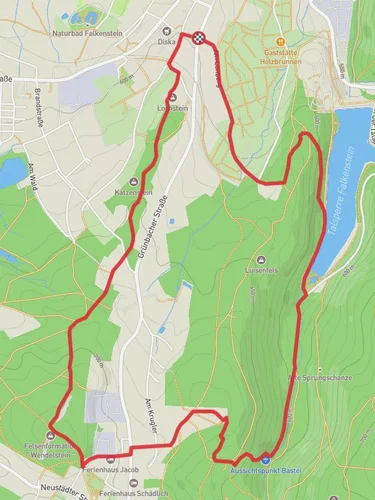
Starting near Vogtlandkreis, Germany, the Beerheide, Rothelstein and Hohengrun Loop via Rothelsteinweg is a captivating 7 km (4.35 miles) loop trail with an elevation gain of approximately 100 meters (328 feet). This medium-difficulty trail offers a blend of natural beauty, historical landmarks, and diverse wildlife, making it a rewarding experience for hikers.
### Getting There To reach the trailhead, you can either drive or use public transport. If driving, set your GPS to Vogtlandkreis, Germany, and look for parking near the village of Beerheide. For those using public transport, take a train to Auerbach (Vogtl) station and then a local bus to Beerheide. The trailhead is conveniently located near the village, making it easily accessible.
### Trail Highlights #### Rothelsteinweg Starting from Beerheide, the trail initially follows the Rothelsteinweg, a historic path that has been used for centuries. As you walk, you'll notice the well-preserved stone markers that date back to medieval times, guiding travelers through the dense forests of the Vogtland region.
#### Beerheide Forest The first section of the trail takes you through the lush Beerheide Forest. This area is known for its towering spruce and pine trees, providing ample shade and a serene atmosphere. Keep an eye out for local wildlife such as deer, foxes, and a variety of bird species. The forest floor is often carpeted with wildflowers in the spring and summer, adding a splash of color to your hike.
#### Rothelstein Approximately 3 km (1.86 miles) into the hike, you'll reach Rothelstein, a prominent rock formation that offers stunning views of the surrounding landscape. The elevation gain to this point is about 50 meters (164 feet), making it a moderate climb. This is an excellent spot to take a break, enjoy a snack, and soak in the panoramic views.
#### Hohengrun Continuing on, the trail leads you to Hohengrun, another significant landmark. This area is rich in history, with remnants of ancient settlements and fortifications. The elevation gain here is gradual, adding another 50 meters (164 feet) as you approach the highest point of the trail. Hohengrun is also a great place to observe the diverse flora and fauna of the region, including rare plant species and migratory birds.
### Navigation and Safety To ensure you stay on track, use the HiiKER app for real-time navigation and trail information. The trail is well-marked, but having a reliable navigation tool can enhance your hiking experience and provide peace of mind.
### Historical Significance The Vogtland region, where this trail is located, has a rich history dating back to the medieval period. The stone markers along Rothelsteinweg are a testament to the area's historical importance as a trade route. Additionally, the remnants of ancient settlements near Hohengrun offer a glimpse into the lives of early inhabitants.
### Final Stretch As you loop back towards Beerheide, the trail descends gently, allowing you to enjoy the final stretch without too much exertion. The last 2 km (1.24 miles) take you through open meadows and past small streams, providing a peaceful end to your hike.
This 7 km loop trail offers a perfect blend of natural beauty, historical landmarks, and moderate physical challenge, making it an ideal choice for hikers looking to explore the scenic Vogtland region.
Reviews
User comments, reviews and discussions about the Beerheide, Rothelstein and Hohengrun Loop via Rothelsteinweg, Germany.
5.0
average rating out of 5
4 rating(s)


