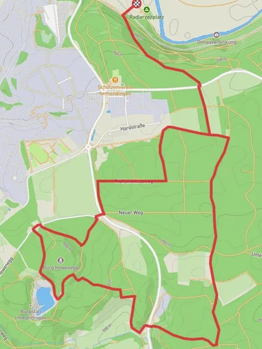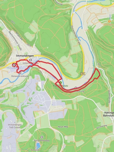
Donauversinkung and Hoewenegg Loop via Schwarzwald Jura Bodens Weg
12.8 km
~3 hrs 15 min
414 m
“Explore Tuttlingen's rich history and natural wonders on this 13 km moderate trail featuring disappearing rivers and serene reserves.”
Starting near the charming town of Tuttlingen, Germany, the Donauversinkung and Hoewenegg Loop via Schwarzwald Jura Bodens Weg is a captivating 13 km (8 miles) loop trail with an elevation gain of approximately 400 meters (1,312 feet). This trail offers a medium difficulty rating, making it suitable for moderately experienced hikers.
### Getting There To reach the trailhead, you can either drive or use public transport. If you're driving, head towards Tuttlingen and look for parking near the town center or designated trail parking areas. For those using public transport, Tuttlingen is well-connected by train. From the Tuttlingen train station, you can either walk to the trailhead or take a local bus to a nearby stop.
### Trail Highlights #### Donauversinkung One of the most fascinating features of this trail is the Donauversinkung, or the "Disappearing Danube." This natural phenomenon occurs where the Danube River vanishes into the porous limestone bedrock, only to reappear later. This geological wonder is located approximately 3 km (1.9 miles) into the hike. The area is well-marked, and there are informational signs explaining the science behind this unique occurrence.
#### Hoewenegg Nature Reserve Around the halfway point of the loop, you'll enter the Hoewenegg Nature Reserve. This area is known for its diverse flora and fauna, including rare orchids and various bird species. The reserve also features a picturesque lake formed in a former quarry, offering a serene spot for a break. Keep an eye out for the information boards that provide insights into the local ecosystem.
### Historical Significance The region around Tuttlingen has a rich history dating back to Roman times. As you hike, you'll come across remnants of ancient settlements and old trade routes. The trail itself follows parts of the Schwarzwald Jura Bodens Weg, a historic path that has been used for centuries. Approximately 8 km (5 miles) into the hike, you'll pass by an old Roman road, a testament to the area's long-standing significance as a travel route.
### Navigation and Safety Given the trail's moderate difficulty, it's advisable to use a reliable navigation tool like HiiKER to stay on track. The trail is well-marked, but having a digital map can be invaluable, especially in the more remote sections of the Hoewenegg Nature Reserve.
### Wildlife and Nature The trail offers a rich tapestry of natural beauty. In addition to the unique geological features and diverse plant life, you may encounter various wildlife species. Deer, foxes, and numerous bird species are commonly spotted along the trail. The changing elevations and varied landscapes—from riverbanks to forested areas—provide a dynamic hiking experience.
### Final Stretch As you near the end of the loop, the trail descends back towards Tuttlingen, offering panoramic views of the town and surrounding countryside. This final section is relatively easy, allowing you to cool down and reflect on the diverse experiences the trail has offered.
Whether you're a seasoned hiker or someone looking to explore the natural and historical wonders of the Tuttlingen region, the Donauversinkung and Hoewenegg Loop via Schwarzwald Jura Bodens Weg promises an enriching adventure.
Reviews
User comments, reviews and discussions about the Donauversinkung and Hoewenegg Loop via Schwarzwald Jura Bodens Weg, Germany.
4.0
average rating out of 5
3 rating(s)


