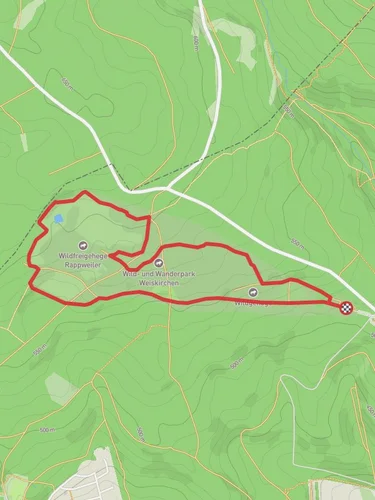
10.7 km
~2 hrs 37 min
290 m
“Explore lush forests, historical ruins, and scenic overlooks on this moderately challenging 11 km trail near Mandern.”
Starting near Trier-Saarburg, Germany, this 11 km (approximately 6.8 miles) loop trail offers a moderate challenge with an elevation gain of around 200 meters (656 feet). The trailhead is easily accessible by car or public transport. If you're driving, you can park near the village of Mandern. For those using public transport, take a train to Trier and then a local bus to Mandern.
### Trail Overview
The trail begins in the charming village of Mandern, known for its picturesque landscapes and historical significance. As you set off, you'll quickly find yourself immersed in a lush forest, where the path meanders through dense foliage and towering trees. The initial section is relatively flat, making it a good warm-up for the more challenging parts ahead.
### Key Landmarks and Points of Interest
Mandern Castle Ruins: About 3 km (1.9 miles) into the hike, you'll come across the ruins of Mandern Castle. This medieval structure, though mostly in ruins, offers a glimpse into the region's rich history. Take a moment to explore the remnants and imagine the lives of those who once inhabited this fortress.
Scenic Overlook: Approximately 5 km (3.1 miles) into the trail, you'll reach a scenic overlook that provides stunning views of the surrounding countryside. This is a great spot to take a break, enjoy a snack, and capture some photos.
Wildlife and Flora: The trail is home to a variety of wildlife, including deer, foxes, and numerous bird species. Keep an eye out for these creatures, especially in the early morning or late afternoon. The forest is also rich with diverse plant life, from ancient oaks to vibrant wildflowers, depending on the season.
### Elevation and Terrain
The trail features a mix of terrains, including forest paths, open meadows, and rocky sections. The elevation gain is gradual but steady, with the most significant climb occurring around the halfway mark. This section can be a bit strenuous, so take your time and enjoy the surroundings.
### Navigation
To ensure you stay on track, it's recommended to use the HiiKER app, which provides detailed maps and real-time navigation. The trail is well-marked, but having a reliable navigation tool can enhance your hiking experience and provide peace of mind.
### Historical Significance
The region around Trier-Saarburg is steeped in history, dating back to Roman times. Trier itself is one of the oldest cities in Germany, founded by the Romans in 16 BC. As you hike, you'll be walking through an area that has seen centuries of human activity, from ancient Roman settlements to medieval fortresses.
### Getting There
For those driving, set your GPS to Mandern, Trier-Saarburg, and look for parking near the village center. If you're using public transport, take a train to Trier, then a local bus to Mandern. The bus ride offers scenic views of the countryside and is a relaxing way to start your adventure.
This trail offers a perfect blend of natural beauty, historical intrigue, and moderate physical challenge, making it an ideal choice for hikers looking to explore the rich landscapes of the Trier-Saarburg region.
Reviews
User comments, reviews and discussions about the Mandern 1, Germany.
0.0
average rating out of 5
0 rating(s)


