3.5 km
~1 hrs 34 min
530 m
“Embark on a scenic, moderately challenging hike through Bavarian Alps' lush forests and panoramic vistas.”
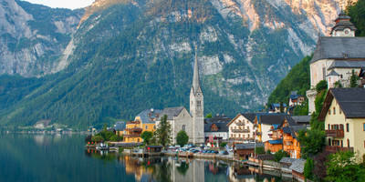
Starting near Traunstein, Germany, the Hochfelln and SalzAlpenSteig trail offers a captivating journey through the Bavarian Alps. This point-to-point trail spans approximately 3 kilometers (1.86 miles) with an elevation gain of around 500 meters (1,640 feet), making it a moderately challenging hike suitable for those with a reasonable level of fitness.
### Getting There To reach the trailhead, you can either drive or use public transportation. If driving, head towards Traunstein, where you can find parking options near the starting point. For those using public transport, take a train to Traunstein station. From there, local buses or a short taxi ride will get you to the trailhead.
### Trail Overview The trail begins with a gentle ascent through lush forests, offering a serene start to your hike. As you progress, the path becomes steeper, winding through dense woodland and opening up to panoramic views of the surrounding valleys and mountains. The trail is well-marked, but it's advisable to use the HiiKER app for precise navigation and to stay on track.
### Key Landmarks and Nature About halfway through the hike, you'll encounter the Hochfellnhaus, a charming mountain hut where you can take a break and enjoy some traditional Bavarian refreshments. This spot also provides stunning views of the Chiemgau Alps and, on clear days, you can even see as far as the Berchtesgaden Alps.
Continuing on, the trail leads you through alpine meadows dotted with wildflowers, especially vibrant in the spring and summer months. Keep an eye out for local wildlife, including chamois and marmots, which are commonly seen in this area.
### Historical Significance The SalzAlpenSteig is part of a larger network of trails that historically were used for the transportation of salt, a valuable commodity in the region. As you hike, you'll be walking in the footsteps of traders who once carried salt from the mines in Berchtesgaden to various parts of Europe. This historical context adds a rich layer to your hiking experience, connecting you to the region's cultural heritage.
### Final Ascent The final stretch of the trail involves a more strenuous climb, but the effort is well worth it. As you approach the summit of Hochfelln, the landscape opens up, offering breathtaking 360-degree views. The summit itself is marked by a large cross, a common sight on many Alpine peaks, symbolizing both the physical and spiritual journey of reaching the top.
### Practical Tips Given the elevation gain and the sometimes steep sections, sturdy hiking boots are recommended. Weather in the Alps can be unpredictable, so pack layers and be prepared for sudden changes. Ensure you have enough water and snacks, especially if you plan to spend time at the summit.
Using the HiiKER app will help you stay on course and provide additional information about the trail and its surroundings. Whether you're a seasoned hiker or someone looking to explore the beauty of the Bavarian Alps, this trail offers a rewarding and enriching experience.

Reviews
User comments, reviews and discussions about the Hochfelln and SalzAlpenSteig, Germany.
5.0
average rating out of 5
2 rating(s)