8.8 km
~2 hrs 4 min
180 m
“Explore Thuringian Forest's diverse landscapes and rich history on the captivating 9 km Rosenkopf-Schneekopf Loop.”
Starting near Suhl, Germany, the Rosenkopf, Hochmoor am Großen Beerberg, and Schneekopf Loop is a captivating 9 km (5.6 miles) loop trail with an elevation gain of approximately 100 meters (328 feet). This trail offers a medium difficulty rating, making it suitable for moderately experienced hikers.
### Getting There To reach the trailhead, you can drive to Suhl, a town in Thuringia, Germany. If you prefer public transport, Suhl is accessible by train, with connections from major cities like Erfurt and Meiningen. From the Suhl train station, local buses or taxis can take you to the trailhead, which is located near the Großer Beerberg, the highest peak in the Thuringian Forest.
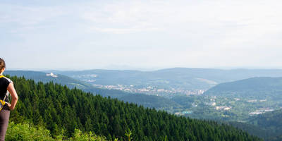
### Trail Highlights #### Rosenkopf The trail begins with a gentle ascent towards Rosenkopf. This section is characterized by dense forest and a variety of flora. Keep an eye out for native wildlife such as deer and various bird species. The forest canopy provides ample shade, making this part of the hike quite pleasant even on warmer days.
#### Hochmoor am Großen Beerberg As you approach the Hochmoor am Großen Beerberg, the terrain changes to a high moorland. This area is particularly fascinating due to its unique ecosystem. The high moor is home to rare plant species like sundews and cotton grass. The trail here is well-marked, but the ground can be soft and boggy, so waterproof hiking boots are recommended.
#### Schneekopf Continuing on, you will reach the Schneekopf, the second-highest peak in the Thuringian Forest. At an elevation of 978 meters (3,209 feet), the Schneekopf offers panoramic views of the surrounding landscape. On clear days, you can see as far as the Rhön Mountains and the Harz. There is a viewing tower at the summit, which provides an even better vantage point for photography enthusiasts.
### Historical Significance The Thuringian Forest has a rich history dating back to medieval times. The region was once a significant trade route, and remnants of old trade paths can still be found. Additionally, the area around Großer Beerberg was used for military training during the Cold War, adding a layer of historical intrigue to your hike.
### Navigation and Safety For navigation, it is highly recommended to use the HiiKER app, which provides detailed maps and real-time updates. The trail is generally well-marked, but having a reliable navigation tool ensures you stay on track, especially in the more remote sections.
### Flora and Fauna Throughout the hike, you'll encounter a diverse range of flora and fauna. The lower elevations are dominated by beech and spruce forests, while the higher elevations feature alpine meadows and moorlands. Wildlife sightings may include red foxes, wild boars, and a variety of bird species such as woodpeckers and owls.
### Practical Tips - Footwear: Waterproof hiking boots are essential, especially for the moorland sections. - Weather: The weather can change rapidly, so bring layers and a waterproof jacket. - Supplies: Carry enough water and snacks, as there are no facilities along the trail. - Timing: The hike can be completed in about 3-4 hours, but allow extra time for breaks and enjoying the scenery.
This trail offers a blend of natural beauty, historical significance, and moderate physical challenge, making it a rewarding experience for those who venture into the Thuringian Forest.
Reviews
User comments, reviews and discussions about the Rosenkopf, Hochmoor am Großen Beerberg and Schneekopf Loop, Germany.
0.0
average rating out of 5
0 rating(s)


