13.2 km
~3 hrs 23 min
452 m
“Embark on the Sengbachtalsperre Loop for stunning views, rich history, and moderate hiking challenges.”
Starting near Solingen, Germany, the Sengbachtalsperre Loop is a captivating 13 km (8 miles) trail with an elevation gain of approximately 400 meters (1,312 feet). This loop trail is rated as medium difficulty, making it suitable for moderately experienced hikers.
### Getting There To reach the trailhead, you can either drive or use public transport. If driving, set your GPS to the Sengbachtalsperre Dam near Solingen. For those using public transport, take a train to Solingen Hauptbahnhof (Solingen Central Station). From there, you can catch a local bus to the "Sengbachtalsperre" stop, which is a short walk from the trailhead.
### Trail Overview The trail begins near the Sengbachtalsperre Dam, a significant landmark in the area. This dam, constructed in the late 19th century, is one of the oldest in Germany and serves as a crucial water reservoir for the region. As you start your hike, you'll be greeted by the serene waters of the reservoir, surrounded by lush forests.
### Key Sections and Landmarks #### Initial Ascent The first part of the trail involves a gentle ascent through dense woodland. This section is about 3 km (1.9 miles) long and gains around 100 meters (328 feet) in elevation. Keep an eye out for various species of birds and small mammals that inhabit this area.
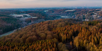
#### Midway Point: Panoramic Views Around the 6 km (3.7 miles) mark, you'll reach a higher elevation offering panoramic views of the surrounding landscape. This is an excellent spot for a short break and some photography. The elevation gain here is more noticeable, adding another 150 meters (492 feet) to your climb.
#### Historical Significance As you continue, you'll come across remnants of old mills and historical buildings, some dating back to the 18th century. These structures offer a glimpse into the region's industrial past, particularly its role in the textile and metalworking industries.
### Flora and Fauna The trail is rich in biodiversity. You'll pass through mixed forests of beech, oak, and pine trees. During spring and summer, the forest floor is carpeted with wildflowers, including bluebells and wood anemones. Wildlife enthusiasts might spot deer, foxes, and a variety of bird species, including woodpeckers and owls.
### Final Descent The last section of the trail involves a descent back towards the reservoir. This part is about 4 km (2.5 miles) long and drops around 150 meters (492 feet) in elevation. The path can be a bit rocky, so watch your step. As you approach the end of the loop, you'll once again be treated to views of the Sengbachtalsperre Dam.
### Navigation For navigation, it's highly recommended to use HiiKER, which provides detailed maps and real-time updates to ensure you stay on track.
### Practical Tips - Wear sturdy hiking boots, as some sections can be rocky and uneven. - Bring enough water and snacks, especially if you plan to take breaks and enjoy the scenery. - Check the weather forecast before you go; the trail can be slippery after rain. - Be mindful of local wildlife and respect their habitat.
This trail offers a perfect blend of natural beauty, historical landmarks, and moderate physical challenge, making it a rewarding experience for any hiker.
Reviews
User comments, reviews and discussions about the Sengbachtalsperre Loop, Germany.
5.0
average rating out of 5
6 rating(s)


