5.6 km
~1 hrs 31 min
239 m
“The River Wupper Loop - Schaberg is a scenic 6 km trail offering nature, history, and wildlife.”
Starting near Solingen, Germany, the River Wupper Loop - Schaberg is a delightful 6 km (3.7 miles) loop trail with an elevation gain of approximately 200 meters (656 feet). This medium-difficulty trail offers a mix of natural beauty, historical landmarks, and opportunities for wildlife spotting.
### Getting There To reach the trailhead, you can either drive or use public transport. If driving, set your GPS to the Schaberg area near Solingen. For those using public transport, take a train to Solingen Hauptbahnhof and then a bus to the Schaberg stop. From there, it's a short walk to the trailhead.
### Trail Overview The trail begins near the historic Müngsten Bridge, the highest railway bridge in Germany, which stands as a testament to late 19th-century engineering. As you start your hike, you'll be greeted by the serene sounds of the River Wupper, which you will follow for a significant portion of the trail.
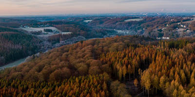
### Key Landmarks and Sections - Müngsten Bridge: Approximately 1 km (0.6 miles) into the hike, you'll pass under this iconic structure. Take a moment to appreciate its architectural grandeur and the lush greenery surrounding it. - Wupper Riverbanks: The trail meanders along the riverbanks for about 2 km (1.2 miles), offering picturesque views and the chance to spot local wildlife such as kingfishers and herons. The gentle flow of the river and the rustling leaves create a peaceful ambiance. - Schaberg Forest: Around the 3 km (1.9 miles) mark, the trail ascends into the Schaberg Forest. This section involves a moderate climb, gaining about 100 meters (328 feet) in elevation. The forest is rich with deciduous trees, and during autumn, the foliage is particularly stunning. - Historical Sites: As you continue, you'll encounter remnants of old mills and industrial sites that hint at the region's historical significance in the textile industry. These sites are well-marked with informational plaques. - Panoramic Viewpoint: At approximately 4.5 km (2.8 miles), you'll reach a viewpoint offering panoramic views of the Wupper Valley. This is an excellent spot for a break and some photography.
### Navigation and Safety The trail is well-marked, but it's always a good idea to have a reliable navigation tool. HiiKER is recommended for its detailed maps and real-time updates. The terrain can be uneven in places, so sturdy hiking boots are advisable. Also, be prepared for muddy sections, especially after rain.
### Flora and Fauna The trail is a haven for nature enthusiasts. In spring and summer, the area is awash with wildflowers, while the forest sections are home to a variety of bird species. Keep an eye out for deer and small mammals that inhabit the woods.
### Final Stretch The last 1.5 km (0.9 miles) of the trail descends gently back towards the river and loops back to the starting point near the Müngsten Bridge. This section is relatively easy and offers a relaxing end to your hike.
This trail is perfect for those looking to combine a moderate physical challenge with rich historical and natural experiences. Whether you're a seasoned hiker or a casual walker, the River Wupper Loop - Schaberg offers something for everyone.
Reviews
User comments, reviews and discussions about the River Wupper Loop - Schaberg, Germany.
5.0
average rating out of 5
6 rating(s)


