12.1 km
~3 hrs 3 min
388 m
“Explore natural beauty, historical landmarks, and vibrant biodiversity on Sigmaringen's scenic 12 km trail.”
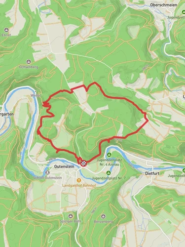
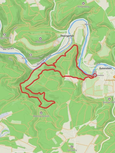
Starting near the picturesque town of Sigmaringen, Germany, this 12 km (approximately 7.5 miles) point-to-point trail offers a delightful mix of natural beauty and historical intrigue. The trailhead is conveniently accessible by both public transport and car. If you're taking public transport, you can catch a train to Sigmaringen station, which is well-connected to major cities like Stuttgart and Ulm. From the station, it's a short walk to the trailhead. For those driving, there are parking facilities available near the trail's starting point.
### Trail Overview
The trail begins with a gentle ascent, gaining around 300 meters (approximately 984 feet) in elevation over its course. The initial section takes you through lush forests and meadows, offering a serene start to your hike. As you progress, the trail runs parallel to the River Donau, providing stunning river views and the soothing sounds of flowing water.
### Significant Landmarks and Nature
Around the 3 km (1.9 miles) mark, you'll encounter the first significant landmark: the ruins of Wildenstein Castle. Perched on a rocky outcrop, this medieval fortress offers panoramic views of the surrounding landscape. It's a great spot for a short break and some photography.
Continuing along the trail, you'll pass through a series of small villages, each with its own unique charm. At approximately 6 km (3.7 miles), you'll reach the village of Gutenstein. Here, you can explore the local church and enjoy a meal at one of the quaint local eateries.
### Flora and Fauna
The trail is rich in biodiversity. Keep an eye out for native wildlife such as deer, foxes, and a variety of bird species. The flora is equally impressive, with seasonal wildflowers adding splashes of color to the landscape. In spring and summer, the meadows are particularly vibrant, making it a great time for nature photography.
### Historical Significance
The region is steeped in history, with the River Donau (Danube) playing a crucial role in the development of European civilizations. The river has been a vital trade route since ancient times, and the surrounding area is dotted with historical sites. The trail itself passes through areas that have been inhabited for centuries, offering a glimpse into the past.
### Navigation and Safety
For navigation, it's highly recommended to use the HiiKER app, which provides detailed maps and real-time updates. The trail is well-marked, but having a reliable navigation tool ensures you stay on track.
Be prepared for varying weather conditions, especially if hiking in the shoulder seasons. The trail can be muddy after rain, so appropriate footwear is essential. Carry enough water and snacks, as there are limited facilities along the route.
### Final Stretch
As you approach the end of the trail near Sigmaringen, the landscape opens up, offering expansive views of the surrounding countryside. The final descent brings you back to the town, where you can explore the impressive Sigmaringen Castle, one of the largest and most well-preserved castles in Germany.
This trail offers a perfect blend of natural beauty, historical landmarks, and cultural experiences, making it a must-do for any hiking enthusiast.
Reviews
User comments, reviews and discussions about the Gutenstein to Sigmaringen Walk via River Donau, Germany.
0.0
average rating out of 5
0 rating(s)


