9.1 km
~2 hrs 8 min
201 m
“Discover a 9-km scenic loop near Schwandorf blending nature, history, and moderate hiking challenges.”
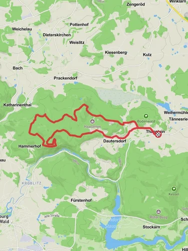
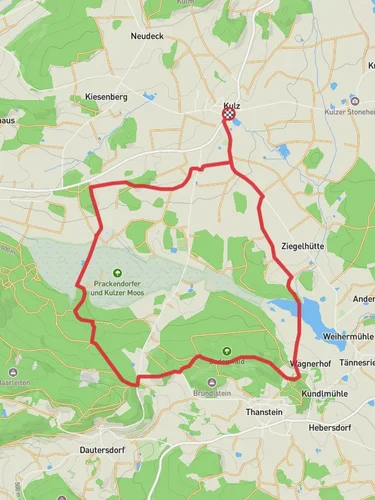
Starting near Schwandorf, Germany, the Altdamm Weiher and Muehlweiher via Moosweg trail is a picturesque loop that spans approximately 9 kilometers (5.6 miles) with an elevation gain of around 200 meters (656 feet). This medium-difficulty trail offers a delightful mix of natural beauty, historical landmarks, and serene water bodies.
### Getting There To reach the trailhead, you can drive to Schwandorf, where parking is available near the starting point. If you prefer public transport, Schwandorf is well-connected by train. From the Schwandorf train station, you can take a local bus or a short taxi ride to the trailhead.
### Trail Overview The trail begins near the charming town of Schwandorf, leading you through lush forests and alongside tranquil ponds. The first significant landmark you'll encounter is the Altdamm Weiher, a serene pond that offers a perfect spot for a brief rest and some bird-watching. This area is rich in avian life, so keep your binoculars handy.
### Historical Significance As you continue, you'll come across remnants of old mills, which are a testament to the region's historical reliance on water-powered industry. These mills, now mostly in ruins, offer a glimpse into the past and are scattered along the trail, particularly near the Muehlweiher pond.
### Nature and Wildlife The trail meanders through dense forests, where you can expect to see a variety of flora and fauna. The forested sections are home to deer, foxes, and a plethora of bird species. The Moosweg path, in particular, is known for its moss-covered trees and ground, creating a fairy-tale-like atmosphere.
### Navigation For navigation, it's highly recommended to use the HiiKER app, which provides detailed maps and real-time updates. The trail is well-marked, but having a reliable navigation tool will ensure you stay on track and can explore any interesting detours.
### Elevation and Terrain The trail's elevation gain is moderate, with some steep sections that require a bit of effort. The highest point offers panoramic views of the surrounding countryside, making the climb well worth it. The terrain varies from well-trodden paths to more rugged sections, so sturdy hiking boots are advisable.
### Points of Interest - Altdamm Weiher: Approximately 2 kilometers (1.2 miles) from the start, this pond is an ideal spot for a break. - Muehlweiher: Around 5 kilometers (3.1 miles) into the hike, this pond is surrounded by historical mill ruins. - Panoramic Viewpoint: Near the highest elevation point, roughly 7 kilometers (4.3 miles) in, offering stunning views.
### Final Stretch The last part of the trail loops back towards Schwandorf, passing through open meadows and small streams. This section is relatively flat and provides a relaxing end to your hike.
This trail offers a balanced mix of natural beauty, historical intrigue, and moderate physical challenge, making it a rewarding experience for any hiker.
Reviews
User comments, reviews and discussions about the Altdamm Weiher and Muehlweiher via Moosweg, Germany.
5.0
average rating out of 5
4 rating(s)


