4.4 km
~1 hrs 12 min
190 m
“Embark on the picturesque Spitzberg Rundweg Loop for a historically rich, medium-difficulty hike in Thuringia.”
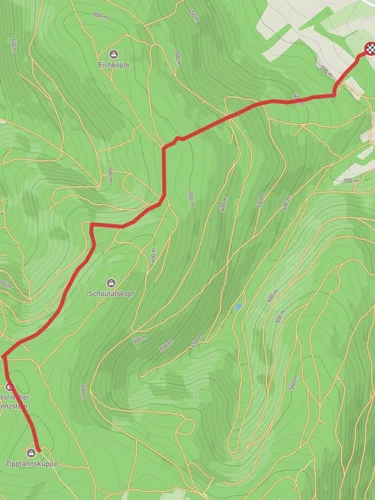
Starting near the picturesque town of Saalfeld-Rudolstadt in Germany, the Spitzberg Rundweg Loop offers a delightful 4 km (2.5 miles) journey through the Thuringian countryside. With an elevation gain of around 100 meters (328 feet), this loop trail is rated as medium difficulty, making it accessible for most hikers while still providing a bit of a challenge.
### Getting There To reach the trailhead, you can either drive or use public transport. If driving, set your GPS to Saalfeld-Rudolstadt and look for parking options near the town center. For those using public transport, the nearest train station is Saalfeld (Saale) Bahnhof. From there, local buses or a short taxi ride will get you to the trailhead.
### Trail Overview The trail begins near the outskirts of Saalfeld-Rudolstadt, a town known for its rich history and beautiful architecture. As you start your hike, you'll quickly find yourself immersed in lush forests and rolling hills. The initial part of the trail is relatively flat, allowing you to ease into the hike.
### Significant Landmarks and Nature About 1 km (0.6 miles) into the hike, you'll come across the first significant landmark: the ruins of an old watchtower. This tower dates back to the medieval period and offers a glimpse into the region's historical significance as a strategic lookout point.
Continuing on, the trail gradually ascends, offering panoramic views of the surrounding Thuringian Forest. At approximately 2 km (1.2 miles), you'll reach the highest point of the trail, where you can take a moment to enjoy the scenery and perhaps spot some local wildlife, such as deer or various bird species.
### Flora and Fauna The Spitzberg Rundweg Loop is home to a diverse range of flora and fauna. Depending on the season, you might see wildflowers in full bloom, adding a splash of color to the landscape. The forested areas are predominantly made up of beech and oak trees, providing ample shade and a cool respite during warmer months.
### Historical Significance The region around Saalfeld-Rudolstadt has a rich history, with evidence of human settlement dating back to the Bronze Age. The trail itself passes through areas that were once part of ancient trade routes, adding an extra layer of historical intrigue to your hike.
### Navigation For navigation, it's highly recommended to use the HiiKER app, which provides detailed maps and real-time updates to ensure you stay on the right path. The trail is well-marked, but having a reliable navigation tool can enhance your hiking experience.
### Final Stretch As you descend back towards Saalfeld-Rudolstadt, the trail winds through open meadows and small streams, offering a peaceful end to your hike. The final kilometer (0.6 miles) is relatively easy, allowing you to cool down and reflect on the natural beauty and historical richness you've just experienced.
Whether you're a seasoned hiker or a casual walker, the Spitzberg Rundweg Loop offers a rewarding adventure through one of Germany's most charming regions.
Reviews
User comments, reviews and discussions about the Spitzberg Rundweg Loop, Germany.
5.0
average rating out of 5
1 rating(s)


