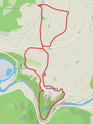
8.3 km
~1 hrs 58 min
191 m
“The Saale Weg trail combines stunning natural beauty, historical intrigue, and moderate challenge for seasoned hikers.”
Starting near the picturesque region of Saale-Orla-Kreis in Germany, this 8 km (approximately 5 miles) point-to-point trail offers a delightful mix of natural beauty and historical intrigue. With an elevation gain of around 100 meters (328 feet), the Saale Weg is estimated to be of medium difficulty, making it suitable for moderately experienced hikers.
### Getting There To reach the trailhead, you can either drive or use public transport. If driving, set your GPS to the nearest known address: Saalburg-Ebersdorf, a charming town that serves as a convenient starting point. For those relying on public transport, the nearest major train station is in Saalfeld, from where you can catch a local bus to Saalburg-Ebersdorf.
### Trail Navigation For navigation, it is highly recommended to use the HiiKER app, which provides detailed maps and real-time updates to ensure you stay on track.
### Trail Highlights As you embark on the Saale Weg, you'll be greeted by the serene beauty of the Saale River, which meanders alongside the trail for a significant portion of the hike. The river's calm waters and lush banks create a tranquil atmosphere, perfect for nature enthusiasts.
#### Flora and Fauna The trail is rich in biodiversity. Keep an eye out for native wildlife such as deer, foxes, and a variety of bird species. The flora is equally impressive, with dense forests of oak and beech trees providing ample shade and a refreshing environment.
#### Historical Significance One of the most captivating aspects of this trail is its historical significance. The region around Saale-Orla-Kreis has a storied past, with remnants of medieval settlements and ancient trade routes. About 3 km (1.8 miles) into the hike, you'll come across the ruins of an old castle, believed to date back to the 12th century. This site offers a glimpse into the region's feudal history and provides a perfect spot for a short rest and some exploration.
### Mid-Trail Landmarks Around the halfway mark, approximately 4 km (2.5 miles) in, you'll encounter a scenic viewpoint that offers panoramic views of the Saale Valley. This is an ideal spot for photography and a brief respite to take in the breathtaking landscape.
### Final Stretch As you approach the final 2 km (1.2 miles) of the trail, the path becomes slightly steeper, adding a bit of a challenge. However, the effort is well worth it as you descend into the quaint village of Ziegenrück. This charming village, with its traditional German architecture and friendly locals, marks the end of your journey.
### Practical Tips - Footwear: Given the mixed terrain, sturdy hiking boots are recommended. - Weather: Check the weather forecast before you set out, as the trail can become slippery after rain. - Supplies: Carry enough water and snacks, as there are limited facilities along the route. - Safety: Always inform someone of your hiking plans and expected return time.
The Saale Weg offers a perfect blend of natural beauty, historical landmarks, and moderate physical challenge, making it a rewarding experience for any hiker.
Reviews
User comments, reviews and discussions about the Saale Weg, Germany.
0.0
average rating out of 5
0 rating(s)


