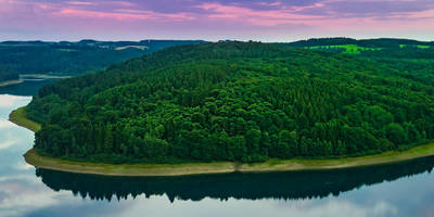
Weyerbach via Biesfelder Straße and Weyermuehle
10.7 km
~2 hrs 27 min
189 m
“Explore Rheinisch-Bergischer Kreis on this 11 km loop, blending moderate trails, scenic views, and historical landmarks.”
Starting near the Rheinisch-Bergischer Kreis in Germany, this 11 km (approximately 6.8 miles) loop trail offers a moderate challenge with an elevation gain of around 100 meters (328 feet). The trailhead is conveniently accessible by both public transport and car. If you're driving, you can park near the Biesfelder Straße. For those using public transport, the nearest significant landmark is the Biesfeld bus stop, which is well-connected to the surrounding areas.
### Trail Navigation and Terrain
The trail begins with a gentle ascent, making it accessible for hikers of varying skill levels. As you start, you'll be walking through a mix of forested areas and open fields. The path is well-marked, but it's always a good idea to have a reliable navigation tool like HiiKER to ensure you stay on track.
### Flora and Fauna
As you make your way through the trail, you'll encounter a diverse range of flora and fauna. The forested sections are home to oak, beech, and pine trees, providing ample shade and a serene atmosphere. Keep an eye out for local wildlife such as deer, foxes, and a variety of bird species. The open fields are often dotted with wildflowers, especially in the spring and summer months, adding a splash of color to your hike.
### Significant Landmarks
Around the 3 km (1.86 miles) mark, you'll come across the Weyermuehle, an old mill that has been a part of the region's history for centuries. This is a great spot to take a break and enjoy the historical significance of the area. The mill is a reminder of the region's agricultural past and offers a picturesque setting for photos.
### Elevation and Views
As you continue, the trail gradually ascends to its highest point, offering panoramic views of the surrounding countryside. The elevation gain is moderate, making it manageable for most hikers. The highest point is around 100 meters (328 feet) above the starting elevation, providing a rewarding vantage point to take in the landscape.
### Historical Significance
The Rheinisch-Bergischer Kreis region has a rich history dating back to medieval times. The trail itself passes through areas that were once significant trade routes. The Weyermuehle mill is a testament to the region's long-standing agricultural traditions. As you hike, you'll be walking through a landscape that has been shaped by centuries of human activity, from farming to forestry.
### Final Stretch
The final stretch of the trail takes you back through a mix of forest and open fields, eventually looping back to the starting point near Biesfelder Straße. This section is relatively flat, allowing you to cool down and reflect on the hike.
### Getting There
To reach the trailhead, if you're driving, set your GPS to Biesfelder Straße, Rheinisch-Bergischer Kreis. For public transport users, the Biesfeld bus stop is the nearest significant landmark. From there, it's a short walk to the trailhead.
This 11 km loop offers a moderate challenge with a mix of natural beauty and historical landmarks, making it a rewarding hike for those looking to explore the Rheinisch-Bergischer Kreis region.
Reviews
User comments, reviews and discussions about the Weyerbach via Biesfelder Straße and Weyermuehle, Germany.
4.0
average rating out of 5
4 rating(s)


