8.4 km
~1 hrs 58 min
181 m
“This 8 km loop trail near Leichlingen offers lush landscapes, historical landmarks, and moderate elevation.”
Starting near the picturesque Rheinisch-Bergischer Kreis in Germany, this 8 km (approximately 5 miles) loop trail offers a delightful mix of natural beauty and historical intrigue. With an elevation gain of around 100 meters (328 feet), the trail is rated as medium difficulty, making it accessible for most hikers with a moderate level of fitness.
### Getting There To reach the trailhead, you can either drive or use public transport. If you're driving, set your GPS to the nearest known address: Leichlingen, a charming town in the Rheinisch-Bergischer Kreis. There are several parking options available in the town. For those using public transport, take a train to Leichlingen Station. From there, it's a short walk to the trailhead.
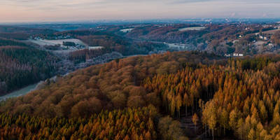
### Trail Overview The trail begins near the outskirts of Leichlingen, immediately immersing you in a lush landscape of rolling hills and verdant forests. The initial section is relatively flat, allowing you to ease into the hike while enjoying the serene surroundings.
### Significant Landmarks and Nature As you progress, you'll encounter a variety of landmarks and natural features. Around the 2 km (1.2 miles) mark, you'll come across the historic Witzhelden Church, a beautiful structure dating back to the medieval period. This church is a testament to the region's rich history and offers a perfect spot for a brief rest and some photographs.
Continuing on, the trail meanders through orchards and fields, showcasing the area's agricultural heritage. Depending on the season, you might see apple, pear, and cherry trees in full bloom or laden with fruit. This section is particularly scenic and offers numerous opportunities for birdwatching, with species like the European robin and the great tit frequently spotted.
### Elevation and Terrain The trail's elevation gain is gradual, with the most significant ascent occurring between the 4 km (2.5 miles) and 6 km (3.7 miles) marks. Here, you'll climb approximately 50 meters (164 feet) over a series of gentle slopes. The terrain varies from well-trodden paths to more rugged sections, so sturdy hiking boots are recommended.
### Wildlife and Flora The forested areas are home to a variety of wildlife, including deer, foxes, and a plethora of bird species. Keep an eye out for the vibrant European jay and the elusive Eurasian nuthatch. The flora is equally diverse, with oak, beech, and pine trees dominating the landscape. In spring and summer, the forest floor is carpeted with wildflowers, adding a splash of color to your hike.
### Navigation For navigation, it's advisable to use the HiiKER app, which provides detailed maps and real-time updates. This will help you stay on track and ensure you don't miss any of the trail's highlights.
### Historical Significance The region around Leichlingen has a rich history, dating back to Roman times. The trail itself passes through areas that were once part of ancient trade routes. The presence of old farmhouses and mills along the way offers a glimpse into the rural life of centuries past.
### Final Stretch As you near the end of the loop, the trail descends gently back towards Leichlingen. This final stretch offers panoramic views of the surrounding countryside, making it a perfect way to end your hike.
Reviews
User comments, reviews and discussions about the Obstweg Leichlingen, Germany.
4.0
average rating out of 5
1 rating(s)


