11.4 km
~2 hrs 44 min
279 m
“The Winterscheidermuehle Rundweg is a scenic 11-km loop trail with natural beauty, historical landmarks, and serene landscapes.”
Starting near Rhein-Sieg-Kreis, Germany, the Winterscheidermuehle Rundweg is a picturesque loop trail that spans approximately 11 kilometers (around 6.8 miles) with an elevation gain of about 200 meters (656 feet). This medium-difficulty trail offers a delightful mix of natural beauty, historical landmarks, and serene landscapes, making it a rewarding experience for hikers.
### Getting There To reach the trailhead, you can either drive or use public transport. If driving, set your GPS to Winterscheidermuehle, a small locality near Rhein-Sieg-Kreis. For those using public transport, take a train to the nearest major station, such as Siegburg/Bonn, and then a local bus to Winterscheidermuehle. The trailhead is conveniently located near the bus stop, making it easily accessible.
### Trail Navigation For navigation, it's highly recommended to use the HiiKER app, which provides detailed maps and real-time updates to ensure you stay on track throughout your hike.
### Trail Highlights The trail begins with a gentle ascent through lush forests, where you can enjoy the shade of towering trees and the sound of rustling leaves. After about 2 kilometers (1.2 miles), you'll reach a scenic viewpoint offering panoramic views of the surrounding countryside. This is a great spot to take a break and soak in the beauty of the region.
Continuing along the trail, you'll come across the historic Winterscheidermuehle Mill, a charming relic from the past. The mill, which dates back several centuries, is a testament to the region's rich history and offers a glimpse into the traditional way of life. Be sure to take some time to explore the area and perhaps snap a few photos.
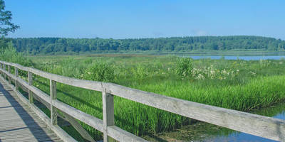
### Flora and Fauna As you hike further, the trail meanders through open meadows and fields, where you might spot a variety of wildlife, including deer, foxes, and numerous bird species. The diverse flora includes wildflowers, ferns, and various types of moss, adding to the trail's natural allure.
### Midpoint and Elevation Gain Around the 5.5-kilometer (3.4-mile) mark, you'll reach the highest point of the trail, with an elevation gain of approximately 200 meters (656 feet). This section offers stunning views of the rolling hills and valleys below, making the climb well worth the effort.
### Descending and Completing the Loop The descent is gradual and takes you through more forested areas and past a few small streams. The sound of flowing water adds a soothing backdrop to this part of the hike. As you near the end of the loop, you'll pass through a quaint village where you can stop for refreshments or a meal at a local café.
### Historical Significance The region around Rhein-Sieg-Kreis has a rich history, with evidence of human settlement dating back to Roman times. The Winterscheidermuehle Mill itself is a significant historical landmark, reflecting the agricultural heritage of the area. Exploring this trail offers not just natural beauty but also a deep connection to the past.
### Final Stretch The final stretch of the trail brings you back to the starting point near Winterscheidermuehle. This loop trail is well-marked and maintained, making it suitable for hikers of various skill levels. Whether you're a seasoned hiker or a casual walker, the Winterscheidermuehle Rundweg offers a fulfilling outdoor adventure.
Reviews
User comments, reviews and discussions about the Winterscheidermuehle Rundweg, Germany.
0.0
average rating out of 5
0 rating(s)


