10.0 km
~2 hrs 27 min
273 m
“Explore lush forests, historical mills, and serene lake views on this moderately challenging 10 km loop.”
Starting near Rhein-Sieg-Kreis, Germany, this 10 km (6.2 miles) loop trail offers a moderate challenge with an elevation gain of approximately 200 meters (656 feet). The trailhead is conveniently accessible by both car and public transport. If you're driving, you can park near the town of Hennef, which is the closest significant landmark. For those using public transport, Hennef (Sieg) station is well-connected by regional trains and buses, making it a practical starting point.
### Trail Overview
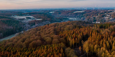
The trail begins with a gentle ascent through lush forests, providing a serene atmosphere as you make your way towards Muehlenberg Ost. The initial 2 km (1.2 miles) are relatively easy, allowing you to warm up and enjoy the natural surroundings. Keep an eye out for local wildlife such as deer and various bird species that inhabit the area.
### Muehlenberg Ost
As you approach Muehlenberg Ost, the trail becomes steeper, gaining about 100 meters (328 feet) in elevation over the next 3 km (1.9 miles). This section offers panoramic views of the surrounding countryside, making it a perfect spot for a short break and some photography. The area is rich in history, with remnants of old mills that date back to the medieval period. These mills were once vital to the local economy, and you can still see some of the old millstones and foundations.
### Allner See
Continuing on, the trail descends towards Allner See, a picturesque lake that serves as a popular spot for both locals and visitors. The descent is gradual, covering about 2 km (1.2 miles) and losing approximately 50 meters (164 feet) in elevation. The lake is surrounded by a variety of flora, including oak and beech trees, and is home to several species of waterfowl. It's an ideal location for a picnic or a leisurely stroll along the shoreline.
### Return Loop
The final leg of the trail takes you back through a mix of forested areas and open meadows, completing the loop. This section is relatively flat, making for an easy and relaxing end to your hike. The last 3 km (1.9 miles) bring you back to the trailhead near Hennef, where you can easily find your way back to your car or public transport options.
### Navigation and Safety
For navigation, it is highly recommended to use the HiiKER app, which provides detailed maps and real-time updates. The trail is well-marked, but having a reliable navigation tool can enhance your hiking experience and ensure you stay on track.
### Historical Significance
The region around Rhein-Sieg-Kreis has a rich history, with evidence of human settlement dating back to the Roman era. The old mills near Muehlenberg Ost are a testament to the area's medieval past, offering a glimpse into the lives of the people who once lived and worked here. The trail itself follows part of the Bergischer Weg, an ancient route that has been used for centuries by traders and travelers.
This hike offers a blend of natural beauty, historical landmarks, and moderate physical challenge, making it a rewarding experience for hikers of all levels.
Reviews
User comments, reviews and discussions about the Muehlenberg Ost and Allner See via Bergischer Weg, Germany.
5.0
average rating out of 5
4 rating(s)


