9.7 km
~2 hrs 20 min
242 m
“Explore the Kraeuterweg and Ohlig Loop: a 10 km scenic hike with forests, meadows, and historical landmarks.”
Starting near Rhein-Sieg-Kreis, Germany, the Kraeuterweg and Ohlig Loop is a delightful 10 km (6.2 miles) loop trail with an elevation gain of approximately 200 meters (656 feet). This trail is rated as medium difficulty, making it suitable for moderately experienced hikers.
### Getting There To reach the trailhead, you can drive or use public transport. If driving, set your GPS to the nearest known address: "Am Kraeuterweg, 53773 Hennef (Sieg), Germany." For those using public transport, take a train to Hennef (Sieg) station. From there, you can catch a local bus or taxi to the trailhead, which is a short distance away.
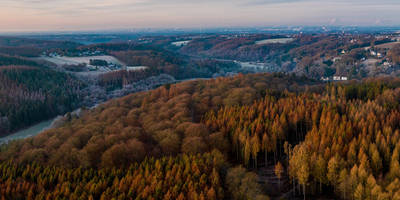
### Trail Overview The Kraeuterweg and Ohlig Loop offers a mix of forested paths, open meadows, and charming rural landscapes. The trail is well-marked, but it's always a good idea to have a reliable navigation tool like HiiKER to ensure you stay on track.
### Key Sections and Landmarks - Initial Ascent: The trail begins with a gentle ascent through a dense forest. This section is about 2 km (1.2 miles) long and gains around 50 meters (164 feet) in elevation. The forest is home to a variety of bird species, so keep an ear out for their songs. - Meadow Views: After the initial climb, the trail opens up into picturesque meadows. This is a great spot to take a break and enjoy the panoramic views of the surrounding countryside. The meadows are particularly beautiful in spring and summer when wildflowers are in full bloom.
- Historical Significance: Around the 5 km (3.1 miles) mark, you'll come across the remnants of an old Roman road. This section of the trail offers a glimpse into the region's rich history, as these roads were once vital for trade and military movements.
- Ohlig Hill: The trail then leads you to Ohlig Hill, the highest point of the loop. The ascent to the hill is about 1 km (0.6 miles) with an elevation gain of 100 meters (328 feet). From the top, you can enjoy stunning views of the Rhein-Sieg-Kreis region. This is a perfect spot for a picnic.
- Descent and Return: The descent from Ohlig Hill is gradual and takes you back through mixed forests and small streams. This section is approximately 3 km (1.9 miles) and is relatively easy, allowing you to enjoy the serene environment.
### Flora and Fauna The trail is rich in biodiversity. In the forested areas, you might spot deer, foxes, and various bird species. The meadows are home to butterflies and bees, especially during the warmer months. Keep an eye out for medicinal herbs, as the trail's name "Kraeuterweg" suggests, which translates to "Herb Way."
### Preparation Tips - Footwear: Wear sturdy hiking boots as some sections can be muddy, especially after rain. - Water and Snacks: Carry enough water and snacks, as there are no facilities along the trail. - Weather: Check the weather forecast before heading out. The trail can be slippery in wet conditions. - Navigation: Use HiiKER for real-time navigation and to stay updated on any trail changes.
This trail offers a perfect blend of natural beauty, historical intrigue, and moderate physical challenge, making it a rewarding experience for any hiker.
Reviews
User comments, reviews and discussions about the Kraeuterweg and Ohlig Loop, Germany.
0.0
average rating out of 5
0 rating(s)


