11.1 km
~2 hrs 31 min
183 m
“Embark on the Kraeuterweg and Breidht Rundweg Loop for a scenic, historical, and moderately challenging 11 km hike.”
Starting your hike near Rhein-Sieg-Kreis, Germany, the Kraeuterweg and Breidht Rundweg Loop is a delightful 11 km (approximately 6.8 miles) journey with an elevation gain of around 100 meters (328 feet). This loop trail is rated as medium difficulty, making it accessible for most hikers with a moderate level of fitness.
### Getting There To reach the trailhead, you can drive or use public transportation. If driving, set your GPS to the nearest known address: Rhein-Sieg-Kreis, Germany. For those using public transport, take a train to the nearest major station, such as Bonn Hauptbahnhof, and then a local bus to the trailhead area. Check local schedules for the most accurate and up-to-date information.
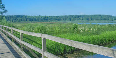
### Trail Overview The trail begins with a gentle ascent, allowing you to ease into the hike. The initial section is well-marked and takes you through lush forests and open meadows. As you progress, you'll encounter a variety of flora, including aromatic herbs that give the Kraeuterweg (Herb Path) its name. Keep an eye out for informational signs that describe the different herbs and their uses.
### Significant Landmarks Around the 3 km (1.9 miles) mark, you'll come across the first significant landmark: an old stone bridge that dates back to the medieval period. This bridge is a great spot for a short break and some photos. Continuing on, the trail leads you to a small chapel, which is approximately 5 km (3.1 miles) into the hike. This chapel has historical significance, serving as a place of worship for local villagers for centuries.
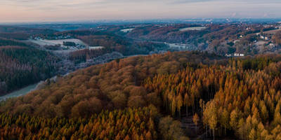
### Nature and Wildlife The trail is rich in biodiversity. As you hike, you may spot various bird species, including woodpeckers and songbirds. Small mammals like squirrels and rabbits are also common. The forested sections are particularly beautiful in the spring and autumn, offering a vibrant display of colors.
### Midpoint and Elevation At around the 6 km (3.7 miles) mark, you'll reach the highest point of the trail, offering panoramic views of the surrounding countryside. This is an excellent spot for a longer rest and a picnic. The elevation gain here is gentle, making it a manageable climb for most hikers.
### Navigation and Safety The trail is well-marked, but it's always a good idea to have a reliable navigation tool. HiiKER is recommended for its detailed maps and real-time updates. Make sure to wear sturdy hiking boots, as some sections can be muddy, especially after rain.
### Final Stretch The last 3 km (1.9 miles) of the trail take you through more open meadows and back into the forest, eventually looping back to the starting point. This section is relatively flat, allowing you to cool down and enjoy the final moments of your hike.
### Historical Significance The region around Rhein-Sieg-Kreis has a rich history, with evidence of human settlement dating back to the Roman era. The trail itself passes through areas that have been used for agriculture and trade for centuries, adding an extra layer of interest to your hike.
By the end of this 11 km loop, you'll have experienced a diverse range of landscapes, historical landmarks, and natural beauty, making it a rewarding hike for anyone looking to explore the German countryside.
Reviews
User comments, reviews and discussions about the Kraeuterweg and Breidht Rundweg Loop, Germany.
0.0
average rating out of 5
0 rating(s)


