7.0 km
~1 hrs 43 min
202 m
“The Bondorf and Augusthohe Loop is a scenic 7 km hike with lush meadows, historic ruins, and panoramic views.”
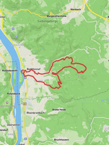
Starting near Rhein-Sieg-Kreis, Germany, the Bondorf and Augusthohe Loop is a delightful 7 km (4.35 miles) trail with an elevation gain of approximately 200 meters (656 feet). This loop trail is rated as medium difficulty, making it suitable for moderately experienced hikers.
### Getting There To reach the trailhead, you can drive or use public transport. If driving, set your GPS to Bondorf, a small village in the Rhein-Sieg-Kreis district. For those using public transport, take a train to the nearby town of Eitorf and then a local bus to Bondorf. The trailhead is conveniently located near the village center, making it easily accessible.
### Trail Overview The trail begins in Bondorf, a quaint village that offers a glimpse into traditional German rural life. As you start your hike, you'll be greeted by lush green meadows and rolling hills. The first section of the trail is relatively flat, allowing you to ease into the hike while enjoying the serene landscape.
### Significant Landmarks and Nature About 2 km (1.24 miles) into the hike, you'll reach the first significant landmark, the Augusthöhe viewpoint. This spot offers panoramic views of the surrounding countryside, including the Sieg River Valley. It's an excellent place to take a break and soak in the natural beauty.
Continuing on, the trail meanders through dense forests, where you might spot local wildlife such as deer, foxes, and a variety of bird species. The forested section is particularly enchanting in the autumn when the leaves turn vibrant shades of red, orange, and yellow.
### Historical Significance Around the 4 km (2.48 miles) mark, you'll come across remnants of old stone walls and foundations. These are believed to be the remains of ancient Roman settlements, adding a layer of historical intrigue to your hike. The region has a rich history dating back to Roman times, and these ruins serve as a testament to its long-standing significance.
### Navigation and Safety As you navigate the trail, it's advisable to use HiiKER for real-time updates and accurate mapping. The trail is well-marked, but having a reliable navigation tool can enhance your hiking experience and ensure you stay on the right path.
### Final Stretch The last 2 km (1.24 miles) of the trail take you through open fields and past small farms, eventually looping back to Bondorf. This section is relatively easy, allowing you to cool down and reflect on the hike. The gentle descent back to the village is a pleasant way to end your journey.
### Wildlife and Flora Throughout the hike, keep an eye out for the diverse flora and fauna. The area is home to various plant species, including wildflowers, ferns, and ancient oak trees. The biodiversity of the region is one of its most appealing features, making every step a new discovery.
### Practical Tips Wear sturdy hiking boots, as some sections of the trail can be rocky and uneven. Bring plenty of water and snacks, especially if you plan to take breaks at the scenic viewpoints. The trail can be muddy after rain, so waterproof gear is recommended.
The Bondorf and Augusthohe Loop offers a perfect blend of natural beauty, historical landmarks, and moderate physical challenge, making it a rewarding experience for any hiker.
Reviews
User comments, reviews and discussions about the Bondorf and Augusthohe Loop, Germany.
5.0
average rating out of 5
3 rating(s)


