6.9 km
~1 hrs 34 min
113 m
“Explore a scenic 7 km loop near Freiendiez with riverside views, historic sites, and lush forests.”
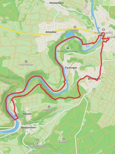
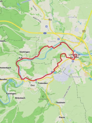
Starting near the picturesque Rhein-Lahn-Kreis in Germany, this loop trail spans approximately 7 kilometers (4.3 miles) with an elevation gain of around 100 meters (328 feet). The trailhead is conveniently located near the town of Freiendiez, making it accessible for both locals and visitors.
### Getting There For those arriving by public transport, the nearest significant landmark is the Diez train station, which is well-connected to major cities like Frankfurt and Koblenz. From the station, it's a short bus ride or a 15-minute walk to the trailhead. If you're driving, there is ample parking available near the trailhead in Freiendiez.
### Trail Overview The trail is classified as medium difficulty, making it suitable for hikers with some experience. The loop format ensures that you return to your starting point, eliminating the need for complex logistics.
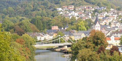
### Key Landmarks and Points of Interest - Freiendiez Castle: Shortly after beginning the hike, you will pass by the historic Freiendiez Castle. This medieval structure offers a glimpse into the region's rich history and is a great spot for a quick photo. - Lahn River Views: As you continue, the trail provides stunning views of the Lahn River. The riverbanks are often teeming with local wildlife, including various bird species and small mammals. - Holzheim Forest: Around the halfway mark, you will enter the serene Holzheim Forest. This section of the trail is particularly lush, with towering trees and a variety of flora. Keep an eye out for deer and other woodland creatures.
### Elevation and Terrain The trail features a moderate elevation gain of about 100 meters (328 feet). The initial ascent is gradual, making it manageable for most hikers. The terrain varies from well-maintained paths to more rugged sections, so sturdy hiking boots are recommended.
### Historical Significance The region around Rhein-Lahn-Kreis is steeped in history. Freiendiez itself dates back to the Roman era, and remnants of ancient settlements can still be found along the trail. The area was also significant during the medieval period, serving as a strategic location for various feudal lords.
### Navigation To ensure you stay on track, it's advisable to use a reliable navigation tool like HiiKER. The app provides detailed maps and real-time updates, which can be particularly useful in the more densely wooded sections of the trail.
### Wildlife and Flora The trail is a haven for nature enthusiasts. In addition to the common European wildlife, the area is known for its diverse plant life. Depending on the season, you may encounter blooming wildflowers, mushrooms, and a variety of tree species.
### Practical Tips - Water and Snacks: There are no facilities along the trail, so be sure to bring enough water and snacks. - Weather: The weather can be unpredictable, so check the forecast and dress in layers. - Safety: While the trail is generally safe, always let someone know your plans and estimated return time.
This loop trail offers a perfect blend of natural beauty, historical intrigue, and moderate physical challenge, making it a rewarding experience for any hiker.
Reviews
User comments, reviews and discussions about the Freiendiez to Holzheim Loop, Germany.
0.0
average rating out of 5
0 rating(s)


