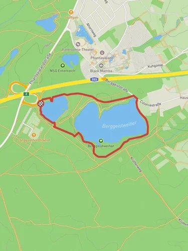
12.9 km
~2 hrs 41 min
73 m
“Explore serene lakes, lush forests, and historical landmarks on this accessible yet diverse 13 km trail!”
Starting near Rhein-Erft-Kreis, Germany, this 13 km (approximately 8 miles) loop trail offers a delightful mix of serene lakes, lush forests, and historical landmarks. With an elevation gain of around 0 meters, this trail is accessible to hikers of varying skill levels, though it is rated as Medium difficulty due to its length and varied terrain.
### Getting There To reach the trailhead, you can drive to the nearest significant landmark, which is the town of Brühl. From Brühl, head towards the Ville region, where you will find ample parking options. If you prefer public transport, take a train to Brühl station and then a local bus towards Ville. The trailhead is conveniently located near the Ville lakes, making it easy to find.
### Trail Highlights
#### Donatussee Starting your hike, you will first encounter Donatussee, a picturesque lake surrounded by dense forest. This area is perfect for birdwatching, so keep your binoculars handy. The lake is named after Saint Donatus, and you might come across a small chapel dedicated to him nearby.
#### Untersee Continuing along the trail, you will reach Untersee, another beautiful lake that offers a tranquil setting. The path around Untersee is well-maintained, making it a pleasant walk. Look out for the diverse flora, including oak and beech trees, which provide ample shade and a cool atmosphere even on warmer days.
#### Franziskussee The final lake on this loop is Franziskussee. This lake is slightly larger and offers several spots perfect for a picnic. The area around Franziskussee is rich in wildlife, including deer and various bird species. The lake is named after Saint Francis, known for his love of nature, which is fitting given the natural beauty of the area.
### Historical Significance The Ville region has a rich history, dating back to Roman times. You might come across remnants of ancient Roman roads and settlements as you hike. The area was also significant during the Middle Ages, with several historical landmarks scattered throughout the trail. Keep an eye out for old stone markers and ruins that tell the story of the region's past.
### Navigation For navigation, it is highly recommended to use the HiiKER app, which provides detailed maps and real-time updates. This will ensure you stay on the correct path and can fully enjoy the trail without worrying about getting lost.
### Wildlife and Flora The trail is home to a variety of wildlife, including deer, foxes, and numerous bird species. The lakes attract waterfowl, and you might even spot a kingfisher if you're lucky. The flora is equally diverse, with oak, beech, and pine trees dominating the landscape. In spring and summer, the trail is adorned with wildflowers, adding a splash of color to your hike.
### Practical Tips - Wear comfortable hiking shoes, as the trail can be uneven in places. - Bring plenty of water and snacks, especially if you plan to picnic by one of the lakes. - Check the weather forecast before you go, as the trail can become muddy after rain. - Use the HiiKER app for navigation to ensure you stay on track.
This trail offers a perfect blend of natural beauty, historical intrigue, and peaceful solitude, making it a must-visit for any hiking enthusiast.
Reviews
User comments, reviews and discussions about the Donatussee, Untersee and Franziskussee via Ville, Germany.
0.0
average rating out of 5
0 rating(s)


