10.6 km
~2 hrs 24 min
175 m
“The Rundwanderweg Bernloch offers 11 km of scenic beauty, historical landmarks, and moderate hiking challenges.”
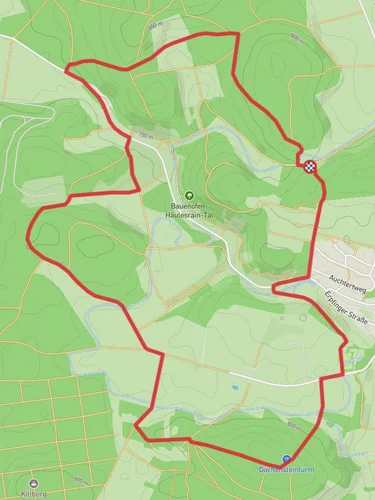
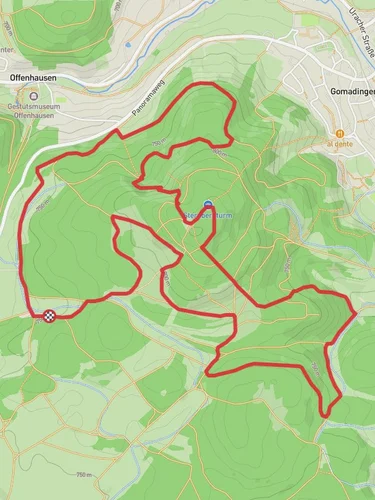
Starting near Reutlingen, Germany, the Rundwanderweg Bernloch is a scenic loop trail that spans approximately 11 km (around 6.8 miles) with an elevation gain of about 100 meters (328 feet). This trail offers a moderate challenge, making it suitable for hikers with some experience.
### Getting There To reach the trailhead, you can drive or use public transport. If driving, set your GPS to Bernloch, a small village near Reutlingen. For those using public transport, take a train to Reutlingen Hauptbahnhof and then a bus to Bernloch. The nearest significant landmark is the Bernloch Church, which is a good starting point for your hike.
### Trail Overview The Rundwanderweg Bernloch is a loop trail, meaning you'll start and end at the same point. The trail is well-marked, but it's always a good idea to have a reliable navigation tool like HiiKER to ensure you stay on track.
### Key Sections and Landmarks
#### Bernloch Village Starting from Bernloch, you'll immediately notice the charming architecture and the peaceful ambiance of this small village. The Bernloch Church, with its historical significance, is a must-see. The church dates back several centuries and offers a glimpse into the region's rich history.
#### Forested Areas As you leave the village, you'll enter a series of forested areas. These sections are particularly beautiful in the fall when the leaves change color. The forest is home to a variety of wildlife, including deer and numerous bird species. Keep an eye out for the European robin and the great spotted woodpecker.
#### Open Fields and Meadows About 4 km (2.5 miles) into the hike, the trail opens up into expansive fields and meadows. These areas offer stunning views of the Swabian Jura, a mountain range known for its limestone formations. The elevation gain here is gradual, making it a pleasant walk. During spring and summer, these meadows are filled with wildflowers, adding a splash of color to your hike.
#### Historical Sites Around the 7 km (4.3 miles) mark, you'll come across some historical sites, including remnants of old farmhouses and stone walls. These structures provide a fascinating look into the agricultural history of the region. Some of these ruins date back to the medieval period, offering a tangible connection to the past.
#### Scenic Overlook One of the highlights of the trail is a scenic overlook located approximately 9 km (5.6 miles) into the hike. From this vantage point, you can see panoramic views of the surrounding countryside. It's an excellent spot for a break and some photography.
### Wildlife and Flora The Rundwanderweg Bernloch is rich in biodiversity. In addition to the aforementioned birds, you might also spot foxes and hares. The flora is equally diverse, with oak, beech, and pine trees dominating the forested sections. In the meadows, look for wildflowers like the common daisy and the European goldenrod.
### Final Stretch The last 2 km (1.2 miles) of the trail bring you back towards Bernloch. This section is relatively flat and easy, allowing you to cool down as you approach the end of your hike. You'll pass through more meadows and small patches of forest before arriving back at the village.
### Preparation Tips Given the moderate difficulty of the trail, it's advisable to wear sturdy hiking boots and bring plenty of water. The trail can be muddy in sections, especially after rain, so be prepared for varying trail conditions. A map on HiiKER will be invaluable for navigation.
This trail offers a perfect blend of natural beauty, historical landmarks, and moderate physical challenge, making it a rewarding experience for any hiker.
Reviews
User comments, reviews and discussions about the Rundwanderweg Bernloch, Germany.
5.0
average rating out of 5
2 rating(s)


