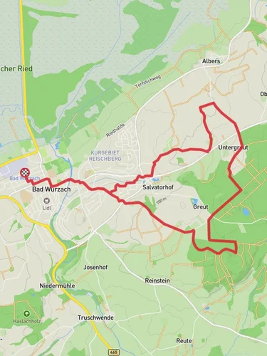
7.7 km
~1 hrs 45 min
139 m
“Explore lush forests and meadows on the Tobelbach via Bachlaeufer trail, near historic Ravensburg.”
Nestled near the charming town of Ravensburg, Germany, the Tobelbach via Bachlaeufer trail offers a delightful loop hike of approximately 8 kilometers (about 5 miles) with an elevation gain of around 100 meters (328 feet). This medium-difficulty trail is perfect for those looking to explore the serene landscapes of southern Germany while enjoying a moderate challenge.
### Getting There
To reach the trailhead, you can drive to Ravensburg, which is well-connected by road. If you're using public transport, Ravensburg is accessible by train from major cities like Stuttgart and Munich. From the Ravensburg train station, local buses or a short taxi ride can take you to the trailhead, located near the outskirts of the town.
### Trail Highlights
As you embark on the Tobelbach via Bachlaeufer loop, you'll be greeted by the lush greenery typical of the region. The trail meanders through dense forests and open meadows, offering a diverse range of scenery. Keep an eye out for the vibrant wildflowers that bloom in the spring and summer months, adding splashes of color to the landscape.
### Nature and Wildlife
The area is home to a variety of wildlife, including deer, foxes, and numerous bird species. Birdwatchers will particularly enjoy the opportunity to spot local and migratory birds. The forested sections of the trail provide a habitat for these creatures, so tread quietly and you might catch a glimpse of them in their natural environment.
### Historical Significance
Ravensburg itself is steeped in history, known for its medieval architecture and as a former Free Imperial City. While the trail primarily showcases natural beauty, the proximity to Ravensburg allows hikers to explore the town's historical sites, such as the iconic Mehlsack tower and the picturesque town square, before or after their hike.
### Navigation and Safety
The trail is well-marked, but it's always wise to have a reliable navigation tool. The HiiKER app is recommended for its detailed maps and real-time updates. Ensure you have appropriate footwear, as some sections can be slippery, especially after rain. The trail is accessible year-round, but the best times to visit are during the spring and fall when the weather is mild and the scenery is particularly stunning.
### Points of Interest
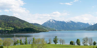
Approximately halfway through the loop, you'll encounter a small, serene stream known as Tobelbach. This is a perfect spot to take a break and enjoy a picnic. The gentle sound of flowing water adds to the tranquility of the setting. As you continue, the trail offers occasional glimpses of the surrounding countryside, with rolling hills and distant views of the Alps on clear days.
Whether you're a seasoned hiker or a nature enthusiast, the Tobelbach via Bachlaeufer trail provides a rewarding experience with its blend of natural beauty and historical context.
Reviews
User comments, reviews and discussions about the Tobelbach via Bachlaeufer, Germany.
4.0
average rating out of 5
5 rating(s)


