13.1 km
~2 hrs 49 min
129 m
“Explore the scenic 13 km Kasseedorfer Seen trail, featuring lakes, historical landmarks, and diverse wildlife.”
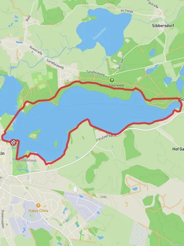
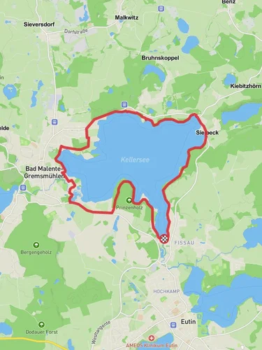
Starting near Ostholstein, Germany, the Stendorfer See and Oberteich via Kasseedorfer Seen trail is a picturesque loop that spans approximately 13 kilometers (8 miles) with an elevation gain of around 100 meters (328 feet). This medium-difficulty trail offers a delightful mix of natural beauty, historical landmarks, and serene lakeside views.
### Getting There To reach the trailhead, you can drive or use public transport. If driving, set your GPS to the nearest known address: Kasseedorf, Ostholstein, Germany. For those using public transport, take a train to Eutin station, which is the closest major station. From Eutin, you can catch a local bus to Kasseedorf, where the trail begins.
### Trail Overview The loop trail begins near the charming village of Kasseedorf. As you start your hike, you'll be greeted by the tranquil waters of Stendorfer See. The trail meanders through lush forests and open meadows, offering a variety of landscapes to enjoy.
### Key Landmarks and Points of Interest - Stendorfer See: Approximately 2 kilometers (1.2 miles) into the hike, you'll reach the shores of Stendorfer See. This lake is perfect for a short break, where you can enjoy the serene waters and perhaps spot some local bird species. - Oberteich: Around the 6-kilometer (3.7-mile) mark, you'll encounter Oberteich, another beautiful lake that offers a peaceful setting for a picnic or a moment of reflection. - Historical Significance: The region around Kasseedorf has a rich history dating back to medieval times. Keep an eye out for old farmhouses and remnants of historical structures that dot the landscape.
### Flora and Fauna The trail is a haven for nature enthusiasts. The forests are home to a variety of tree species, including oak, beech, and pine. In the spring and summer months, the meadows burst into a riot of colors with wildflowers. Wildlife is abundant, and you might spot deer, foxes, and a variety of bird species, including herons and kingfishers near the lakes.
### Navigation and Safety Given the trail's moderate difficulty, it's advisable to use a reliable navigation tool like HiiKER to stay on track. The trail is well-marked, but having a digital map can be very helpful, especially in the denser forest sections.
### Elevation and Terrain The trail features a gentle elevation gain of around 100 meters (328 feet), making it accessible for most hikers. The terrain varies from well-trodden paths to slightly rugged forest trails. Good hiking boots are recommended to navigate the occasional muddy patches and uneven ground.
### Practical Tips - Water and Snacks: Carry enough water and snacks, as there are limited facilities along the trail. - Weather: Check the weather forecast before heading out. The trail can be quite muddy after rain. - Wildlife: Respect the local wildlife. Keep a safe distance and avoid feeding animals.
This trail offers a perfect blend of natural beauty, historical intrigue, and moderate physical challenge, making it an ideal choice for a day hike in the Ostholstein region.
Reviews
User comments, reviews and discussions about the Stendorfer See and Oberteich via Kasseedorfer Seen, Germany.
5.0
average rating out of 5
3 rating(s)


