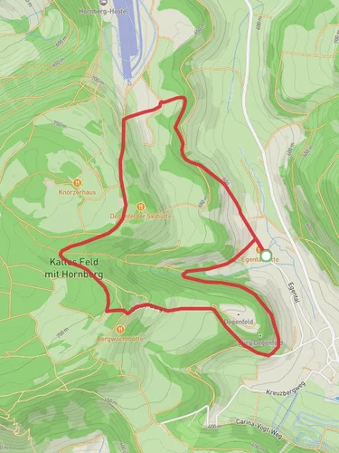
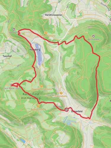
7.5 km
~2 hrs 1 min
310 m
“Explore lush forests, historic heights, and panoramic views on this 8 km scenic loop near Schwäbisch Gmünd.”
Starting near Ostalbkreis, Germany, this 8 km (approximately 5 miles) loop trail offers a moderate challenge with an elevation gain of around 300 meters (about 984 feet). The trailhead is conveniently accessible by car, with parking available near the town of Schwäbisch Gmünd. For those using public transport, you can take a train to Schwäbisch Gmünd station and then a local bus to the trailhead area.
### Initial Ascent and Forested Pathways
The hike begins with a gentle ascent through lush forested areas, providing a serene start to your journey. The initial 2 km (1.2 miles) will take you through dense woods, where you can enjoy the shade and the sounds of local wildlife. Keep an eye out for deer and various bird species that inhabit this region. The trail is well-marked, but it's always a good idea to have the HiiKER app handy for navigation.
### Reaching Steinbuehl
As you continue, you'll reach the Steinbuehl area, approximately 3 km (1.8 miles) into the hike. This section offers stunning panoramic views of the surrounding Swabian Alps. The elevation gain here is more noticeable, so take your time and enjoy the scenery. The open meadows are perfect for a short break, and you might spot some wildflowers depending on the season.
### Kaltes Feld and Historical Significance
Around the 5 km (3.1 miles) mark, you'll arrive at Kaltes Feld, the highest point of the trail. This area is historically significant, as it was once a strategic lookout point during various historical conflicts. The name "Kaltes Feld" translates to "Cold Field," a nod to the often chilly winds that sweep through this elevated area. Here, you can find remnants of old fortifications and enjoy a 360-degree view of the landscape.
### Descent and Return Loop
The descent begins shortly after Kaltes Feld, leading you back through mixed forests and open fields. The final 3 km (1.8 miles) of the trail are relatively easy, allowing you to relax and reflect on the hike. The path loops back to the starting point near Schwäbisch Gmünd, completing the circuit.
### Flora and Fauna
Throughout the hike, you'll encounter a variety of flora and fauna. The forested sections are home to oak, beech, and pine trees, while the meadows are dotted with wildflowers like daisies and buttercups. Wildlife enthusiasts will appreciate the chance to see red foxes, hares, and a variety of bird species, including woodpeckers and hawks.
### Practical Tips
- Footwear: Sturdy hiking boots are recommended due to the varied terrain. - Weather: Check the weather forecast before you go, as conditions can change rapidly, especially at higher elevations. - Supplies: Bring enough water and snacks, as there are no facilities along the trail. - Navigation: Use the HiiKER app to stay on track and ensure you don't miss any key landmarks.
This trail offers a perfect blend of natural beauty, historical intrigue, and moderate physical challenge, making it a rewarding experience for hikers of all levels.

Reviews
User comments, reviews and discussions about the Steinbuehl and Kaltes Feld via Nebenlinie des Sav, Germany.
4.0
average rating out of 5
1 rating(s)