Bad Saarow to Wendisch-Rietz via Ufferwanderweg Westufer
13.7 km
~2 hrs 49 min
54 m
“Explore 14 km of scenic beauty and historical intrigue along the accessible trail from Bad Saarow to Wendisch-Rietz.”
Starting near Oder-Spree, Germany, the trail from Bad Saarow to Wendisch-Rietz via Ufferwanderweg Westufer spans approximately 14 kilometers (8.7 miles) with virtually no elevation gain, making it an accessible yet engaging hike for those looking to explore the scenic beauty of the region.
### Getting There To reach the trailhead, you can take a train to Bad Saarow-Pieskow station, which is well-connected from Berlin. From the station, it's a short walk to the starting point. If you're driving, there are parking facilities available near the trailhead in Bad Saarow.
### Trail Overview The trail is a point-to-point route, primarily following the western shore of Scharmützelsee, one of the largest lakes in Brandenburg. The path is well-marked and maintained, making navigation straightforward. For additional navigation support, consider using the HiiKER app.
### Key Landmarks and Sections
#### Bad Saarow Starting in Bad Saarow, a spa town known for its thermal baths and wellness centers, you'll find yourself surrounded by lush greenery and serene waters. The town itself has a rich history dating back to the early 20th century when it became a popular health resort.
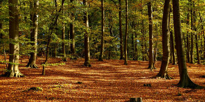
#### Scharmützelsee Shoreline As you proceed along the Ufferwanderweg Westufer, you'll be treated to continuous views of Scharmützelsee. The lake is a haven for birdwatchers, with species such as herons and kingfishers frequently spotted. The trail meanders through dense forests and open meadows, offering a diverse range of flora and fauna.
#### Historical Significance The region around Scharmützelsee has historical significance, particularly from the early 1900s when it became a retreat for Berlin's elite. You might come across old villas and remnants of historical architecture that tell tales of its glamorous past.
#### Wendisch-Rietz The trail concludes in Wendisch-Rietz, a charming village known for its marina and recreational activities. Here, you can relax by the water, rent a boat, or explore local eateries offering traditional German cuisine.
### Wildlife and Nature The trail is abundant with wildlife, including deer, foxes, and a variety of bird species. The forests are primarily composed of pine and beech trees, providing ample shade and a refreshing atmosphere. During spring and summer, the meadows are dotted with wildflowers, adding a splash of color to your hike.
### Practical Information - Distance: 14 km (8.7 miles) - Elevation Gain: 0 meters (0 feet) - Difficulty: Medium - Best Time to Hike: Spring through autumn for the best weather and scenery.
### Navigation and Safety While the trail is well-marked, it's always a good idea to have a reliable navigation tool. The HiiKER app can provide real-time updates and ensure you stay on track. Carry sufficient water, especially during warmer months, and wear comfortable hiking shoes suitable for mixed terrain.
This trail offers a perfect blend of natural beauty, historical intrigue, and recreational opportunities, making it a must-visit for hikers in the region.
Reviews
User comments, reviews and discussions about the Bad Saarow to Wendisch-Rietz via Ufferwanderweg Westufer, Germany.
4.0
average rating out of 5
6 rating(s)


