Download
3D Flyover
Add to list
More
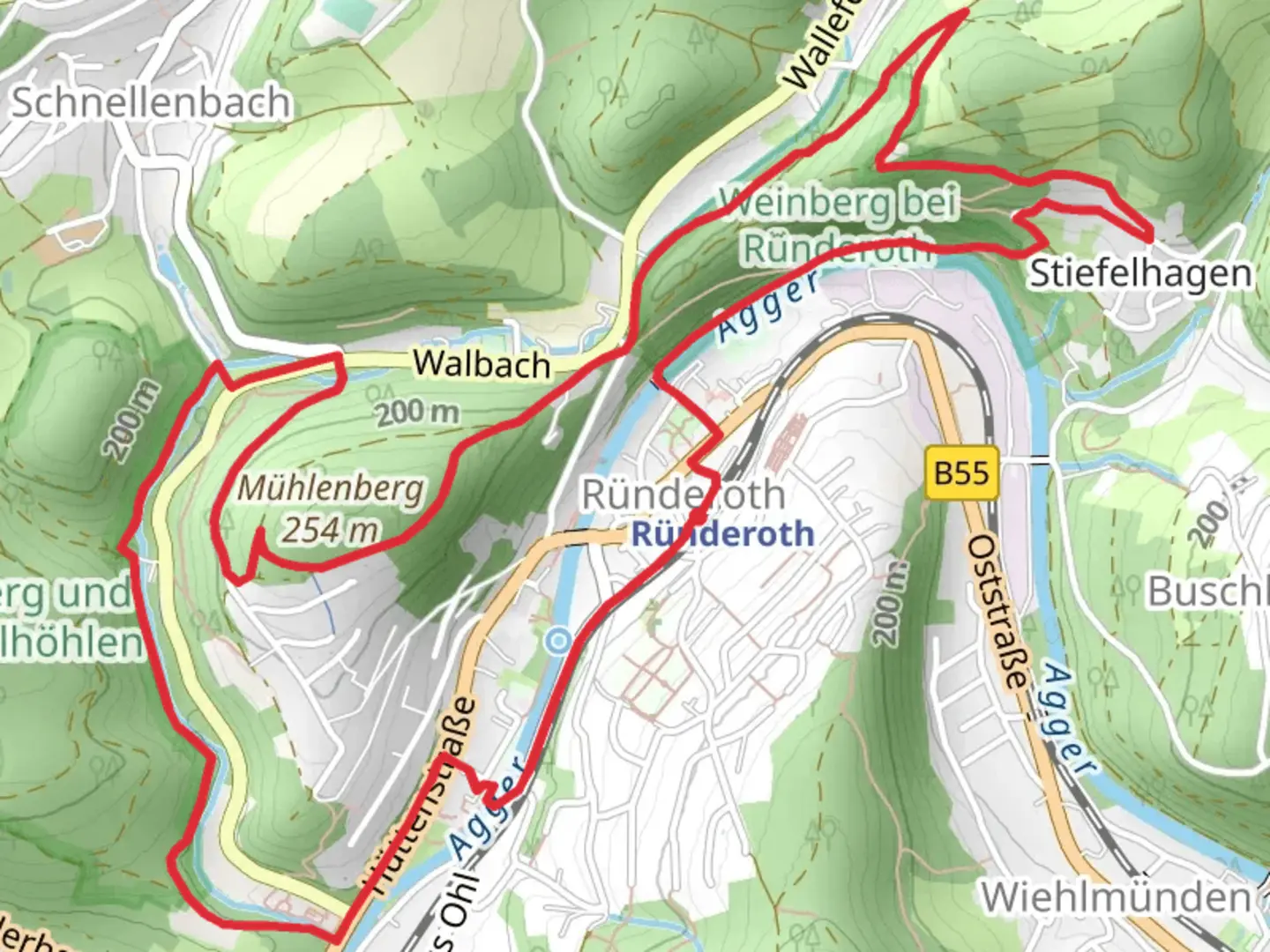
8.1 km
~1 hrs 57 min
205 m
Loop
“Discover the Agger via Hoehlenweg trail: 8 km of lush forests, historical intrigue, and panoramic views.”
Starting near the picturesque region of Oberbergischer Kreis in Germany, this 8 km (approximately 5 miles) loop trail offers a delightful mix of natural beauty and moderate challenge, making it perfect for hikers looking for a rewarding day out. With an elevation gain of around 200 meters (656 feet), the trail is rated as medium difficulty, suitable for those with some hiking experience.
Getting There
To reach the trailhead, you can drive or use public transport. If driving, set your GPS to the nearest significant landmark, which is the town of Gummersbach. From there, follow local signs to Oberbergischer Kreis. For those using public transport, take a train to Gummersbach Station. From the station, you can catch a local bus or taxi to the trailhead.
Trail Navigation
For navigation, it's highly recommended to use the HiiKER app, which provides detailed maps and real-time updates. The trail is well-marked, but having a reliable navigation tool will enhance your experience and ensure you stay on track.
Trail Highlights
The trail begins with a gentle ascent through lush forests, offering a serene start to your hike. As you progress, you'll encounter the Hoehlenweg, a section known for its fascinating rock formations and small caves. This part of the trail is particularly enchanting, with moss-covered rocks and the sound of rustling leaves creating a magical atmosphere.
Flora and Fauna
The Agger via Hoehlenweg trail is rich in biodiversity. Keep an eye out for native wildlife such as deer, foxes, and a variety of bird species. The forested areas are home to oak, beech, and pine trees, providing ample shade and a cool environment even during warmer months.
Historical Significance
The region around Oberbergischer Kreis has a rich history dating back to medieval times. As you hike, you'll come across remnants of old stone walls and possibly even ancient boundary markers. These historical elements add an extra layer of intrigue to your hike, connecting you to the past inhabitants of this beautiful area.
Midpoint and Scenic Views
Around the midpoint of the trail, you'll reach a higher elevation offering stunning panoramic views of the surrounding countryside. This is an excellent spot to take a break, enjoy a snack, and soak in the scenery. The elevation gain here is about 100 meters (328 feet) from the start, making it a rewarding climb.
Final Stretch
The descent takes you through more open landscapes, with meadows and small streams adding variety to the terrain. The final stretch of the trail loops back towards the starting point, passing through a charming village where you can explore local shops and cafes.
Practical Tips
- Wear sturdy hiking boots as some sections can be rocky and uneven.
- Bring plenty of water and snacks, especially if you plan to take your time exploring the caves and historical sites.
- Check the weather forecast before heading out, as the trail can become slippery in wet conditions.
- Use the HiiKER app for real-time navigation and updates.
This trail offers a perfect blend of natural beauty, moderate challenge, and historical intrigue, making it a must-visit for any hiking enthusiast.

What to expect?
Activity types
Comments and Reviews
User comments, reviews and discussions about the Agger via Hoehlenweg, Germany.
4.5
average rating out of 5
2 rating(s)