9.7 km
~3 hrs 29 min
933 m
“Experience the stunning Allgäu Alps on a 10 km loop with panoramic views and historical intrigue.”
Starting your hike near Oberallgäu, Germany, the Grünten via Wanderwegenetz Sonthofen trail offers a rewarding loop of approximately 10 km (6.2 miles) with an elevation gain of around 900 meters (2,950 feet). This medium-difficulty trail is perfect for those looking to experience the beauty of the Allgäu Alps.
### Getting There To reach the trailhead, you can either drive or use public transport. If driving, head towards the town of Sonthofen in the Oberallgäu district. There are several parking options available near the trailhead. For those using public transport, take a train to Sonthofen station. From there, local buses or a short taxi ride can get you to the starting point.
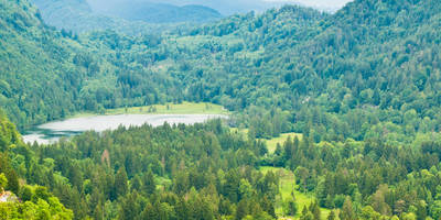
### Trail Overview The trail begins with a gentle ascent through lush meadows and forested areas. Early on, you’ll encounter a mix of gravel paths and well-maintained dirt trails. As you progress, the incline becomes steeper, offering a more challenging climb.
### Key Landmarks and Points of Interest - Alpine Meadows and Forests: The initial part of the hike takes you through picturesque alpine meadows, where you can spot a variety of wildflowers and possibly some grazing cattle. The forested sections provide shade and a serene atmosphere. - Grünten Summit: About halfway through the hike, you’ll reach the summit of Grünten, often referred to as the "Guardian of the Allgäu." At an elevation of 1,738 meters (5,702 feet), the summit offers panoramic views of the surrounding Alps and the Allgäu region. This is a great spot to take a break and enjoy the scenery. - Historical Significance: The Grünten area has historical significance dating back to World War II. You may come across remnants of old bunkers and fortifications, which serve as a reminder of the region's past. - Wildlife: Keep an eye out for local wildlife, including deer, marmots, and various bird species. The diverse ecosystem is a highlight for nature enthusiasts.
### Navigation and Safety Using HiiKER for navigation is highly recommended. The app provides detailed maps and real-time updates, ensuring you stay on the correct path. The trail is well-marked, but having a reliable navigation tool adds an extra layer of security.
### Final Descent and Return The descent takes you through more open meadows and offers a different perspective of the landscape. The trail loops back to the starting point, providing a sense of accomplishment as you complete the circuit.
### Practical Tips - Footwear: Sturdy hiking boots are essential due to the varied terrain and elevation gain. - Weather: Check the weather forecast before you go. The weather in the Alps can change rapidly, so be prepared for sudden shifts. - Supplies: Bring enough water and snacks, as there are limited facilities along the trail. - Timing: Allocate around 4-6 hours to complete the hike, depending on your pace and the number of breaks you take.
This trail offers a blend of natural beauty, historical intrigue, and physical challenge, making it a memorable experience for any hiker.
Reviews
User comments, reviews and discussions about the Grünten via Wanderwegenetz Sonthofen, Germany.
4.0
average rating out of 5
1 rating(s)


