7.3 km
~2 hrs 37 min
699 m
“Experience a moderately challenging 7 km hike through the Allgäu Alps, featuring breathtaking views and historical landmarks.”
Starting near Oberallgäu, Germany, the Grünten trail offers a moderately challenging hike with a distance of around 7 km (4.35 miles) and an elevation gain of approximately 600 meters (1,968 feet). This out-and-back trail is perfect for those looking to experience the beauty of the Allgäu Alps while enjoying a mix of natural landscapes and historical landmarks.
### Getting There To reach the trailhead, you can either drive or use public transportation. If you're driving, head towards the town of Burgberg im Allgäu, which is the nearest significant landmark. There are parking facilities available near the trailhead. For those using public transport, take a train to Sonthofen, the nearest major railway station. From Sonthofen, you can catch a local bus to Burgberg im Allgäu, which is a short ride away.
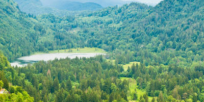
### Trail Overview The trail begins near the base of the Grünten mountain, often referred to as the "Guardian of the Allgäu" due to its prominent position in the region. The initial section of the trail is relatively gentle, winding through lush meadows and dense forests. As you ascend, the path becomes steeper and more rugged, requiring a good level of fitness and sturdy hiking boots.
### Significant Landmarks and Nature At approximately 2 km (1.24 miles) into the hike, you'll come across the Grüntenhütte, a charming mountain hut where you can take a short break and enjoy some local Bavarian snacks. This is also a great spot to refill your water bottles and take in the panoramic views of the surrounding valleys.
Continuing upwards, the trail becomes more challenging, with rocky sections and switchbacks. Around the 4 km (2.48 miles) mark, you'll reach the summit of Grünten. Here, you'll find the Jägerdenkmal, a war memorial dedicated to the mountain troops who fought in World War I. The summit offers breathtaking 360-degree views of the Allgäu Alps, Lake Constance, and even the distant peaks of the Swiss Alps on a clear day.
### Flora and Fauna The Grünten trail is rich in biodiversity. In the lower sections, you'll encounter a variety of wildflowers, including alpine roses and gentians. As you ascend, keep an eye out for local wildlife such as chamois, marmots, and golden eagles soaring above. The dense forests are home to deer and a variety of bird species, making it a paradise for nature enthusiasts.
### Historical Significance The region around Grünten has a rich history. The mountain itself has been a strategic lookout point for centuries, and the Jägerdenkmal at the summit serves as a poignant reminder of the area's military history. The nearby town of Burgberg im Allgäu has historical roots dating back to the Roman era, and you can explore remnants of ancient settlements and medieval architecture.
### Navigation For navigation, it's highly recommended to use the HiiKER app, which provides detailed maps and real-time updates on trail conditions. This will ensure you stay on the right path and can make the most of your hiking experience.
### Final Stretch The descent follows the same path back to the trailhead, offering a different perspective on the stunning landscapes you passed on the way up. Be cautious on the steeper sections, especially if the weather has made the trail slippery.
This hike is best undertaken from late spring to early autumn when the weather is most favorable. Always check the local weather forecast and trail conditions before setting out, and ensure you have adequate clothing, water, and snacks for the journey.
Reviews
User comments, reviews and discussions about the Grünten, Germany.
4.0
average rating out of 5
10 rating(s)


