Graefweiher via Rundwanderweg Bad Windsheim
13.8 km
~3 hrs 0 min
145 m
“Explore serene forests, historical sites, and stunning lake views on this 14 km moderate loop trail.”
Starting near Neustadt an der Aisch-Bad Windsheim, Germany, the Graefweiher via Rundwanderweg Bad Windsheim is a delightful loop trail that spans approximately 14 km (8.7 miles) with an elevation gain of around 100 meters (328 feet). This trail is rated as medium difficulty, making it suitable for moderately experienced hikers.
### Getting There To reach the trailhead, you can either drive or use public transport. If driving, you can park near the town of Bad Windsheim, which is well-signposted and has ample parking facilities. For those using public transport, take a train to Neustadt an der Aisch-Bad Windsheim station. From there, local buses or a short taxi ride will get you to the trailhead.
### Trail Navigation For navigation, it is highly recommended to use the HiiKER app, which provides detailed maps and real-time updates to ensure you stay on track.
### Trail Highlights The trail begins near the picturesque town of Bad Windsheim, known for its charming half-timbered houses and historical significance. As you set off, you will soon find yourself immersed in the serene beauty of the Franconian countryside.
#### Graefweiher Lake One of the first significant landmarks you will encounter is the Graefweiher Lake, approximately 3 km (1.9 miles) into the hike. This tranquil lake is a perfect spot for a short break, offering stunning reflections of the surrounding trees and sky. Birdwatchers will be delighted by the variety of waterfowl that frequent the area.
#### Forested Sections Continuing on, the trail meanders through dense forested sections, providing ample shade and a sense of seclusion. These sections are particularly beautiful in autumn when the foliage turns vibrant shades of red and gold. The forest is home to a variety of wildlife, including deer and foxes, so keep your eyes peeled.
#### Historical Sites Around the halfway mark, approximately 7 km (4.3 miles) in, you will come across several historical sites. One notable landmark is the ruins of an old mill, which offers a glimpse into the region's agricultural past. Information plaques provide context and historical background, making this a great educational stop.
### Elevation and Terrain The trail features gentle rolling hills with an overall elevation gain of about 100 meters (328 feet). The terrain is varied, ranging from well-maintained paths to more rugged sections with roots and rocks. Good hiking boots are recommended to navigate these areas comfortably.
### Flora and Fauna The trail is rich in biodiversity. In spring and summer, wildflowers bloom in abundance, adding splashes of color to the landscape. The mixed deciduous and coniferous forests provide habitats for a variety of bird species, making it a paradise for birdwatchers.
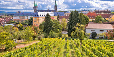
### Final Stretch As you near the end of the loop, the trail brings you back towards Bad Windsheim. The final stretch offers panoramic views of the town and its surrounding vineyards, a perfect way to end your hike.
### Practical Tips - Carry enough water and snacks, as there are limited facilities along the trail. - Check the weather forecast before you go, as the trail can become slippery in wet conditions. - Use the HiiKER app for navigation to ensure you stay on the correct path.
This trail offers a perfect blend of natural beauty, historical intrigue, and moderate physical challenge, making it a rewarding experience for any hiker.
Reviews
User comments, reviews and discussions about the Graefweiher via Rundwanderweg Bad Windsheim, Germany.
5.0
average rating out of 5
3 rating(s)


