3.7 km
~58 min
142 m
“Explore the scenic Rákócziweg Loop near Landshut, Germany, a 4 km hike rich in nature and history.”
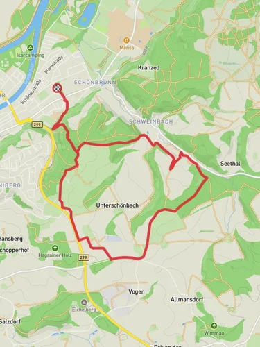
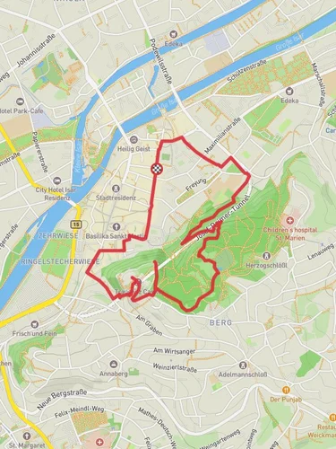
Starting your hike near the picturesque town of Landshut, Germany, the Rákócziweg Loop offers a delightful 4 km (2.5 miles) journey with an elevation gain of approximately 100 meters (328 feet). This loop trail is rated as medium difficulty, making it suitable for moderately experienced hikers.
### Getting There To reach the trailhead, you can either drive or use public transportation. If driving, set your GPS to Landshut, and look for parking options near the town center. For those using public transport, take a train to Landshut Hauptbahnhof (Landshut Central Station). From there, local buses or a short taxi ride will get you to the trailhead.
### Trail Navigation For navigation, HiiKER is an excellent tool to use. It provides detailed maps and real-time updates to ensure you stay on track.
### Trail Highlights As you embark on the Rákócziweg Loop, you'll quickly find yourself immersed in a landscape rich with natural beauty and historical significance.
#### Nature and Wildlife The trail meanders through lush forests and open meadows, offering a variety of flora and fauna. Keep an eye out for native bird species and small mammals that inhabit the area. The forested sections provide ample shade, making it a pleasant hike even during warmer months.
#### Historical Significance The trail is named after Francis II Rákóczi, a Hungarian nobleman and leader of the Hungarian uprising against the Habsburgs in the early 18th century. While the trail itself doesn't feature specific historical landmarks related to Rákóczi, the region's history adds a layer of cultural depth to your hike.
### Key Landmarks - Landshut Castle: Approximately 1 km (0.6 miles) into the hike, you'll come across a viewpoint offering stunning vistas of Landshut Castle. This medieval fortress is a must-see, with its towering walls and rich history. - Isar River: Around the halfway mark, the trail runs parallel to the Isar River for a short distance. This section provides a serene backdrop and is an excellent spot for a quick rest. - Wooden Bridge: At about 3 km (1.9 miles), you'll cross a charming wooden bridge that spans a small creek. This is a great photo opportunity and a chance to appreciate the craftsmanship of local builders.
### Elevation and Terrain The trail features a moderate elevation gain of 100 meters (328 feet), with a few steep sections that require careful footing. The terrain varies from well-trodden paths to rocky segments, so sturdy hiking boots are recommended.
### Preparation Tips - Weather: Check the local weather forecast before heading out. The trail can become slippery after rain, so plan accordingly. - Water and Snacks: Bring enough water and some light snacks to keep your energy levels up. - Clothing: Dress in layers, as the forested areas can be cooler than the open meadows.
### Safety Considerations - Wildlife: While encounters with wildlife are rare, it's always good to be aware of your surroundings. - Trail Markings: The trail is well-marked, but using HiiKER will ensure you stay on the correct path.
By following these guidelines and being well-prepared, you'll have a rewarding experience on the Rákócziweg Loop, enjoying both its natural beauty and historical context.
Reviews
User comments, reviews and discussions about the Rákócziweg Loop, Germany.
0.0
average rating out of 5
0 rating(s)


