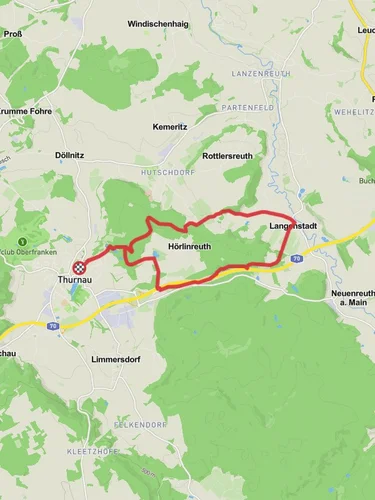
10.9 km
~2 hrs 42 min
315 m
“The Neudrossenfeld to Hohe Wart Walk is a scenic 11-kilometer hike through Franconian landscapes, rich in history and wildlife.”
Starting near Kulmbach, Germany, the Neudrossenfeld to Hohe Wart Walk via Kuhleite is a picturesque point-to-point trail that spans approximately 11 kilometers (around 6.8 miles) with an elevation gain of about 300 meters (approximately 984 feet). This medium-difficulty hike offers a blend of natural beauty, historical landmarks, and a touch of local wildlife.
### Getting There To reach the trailhead, you can either drive or use public transport. If driving, head towards Kulmbach and look for parking near the starting point. For those using public transport, take a train or bus to Kulmbach, and from there, you can either walk or take a local bus to the trailhead.
### Trail Overview The trail begins near Kulmbach, a town known for its rich brewing history and medieval architecture. As you set off, you'll be greeted by rolling hills and lush forests, typical of the Franconian landscape. The initial part of the trail is relatively gentle, allowing you to ease into the hike.
### Key Landmarks and Sections - Kuhleite: About 3 kilometers (1.86 miles) into the hike, you'll reach Kuhleite, a small hill offering panoramic views of the surrounding countryside. This is a great spot for a short break and some photos. - Neudrossenfeld: Approximately halfway through the hike, you'll pass through Neudrossenfeld, a charming village with a rich history. The village is home to the Neudrossenfeld Castle, a Baroque-style building dating back to the 18th century. Take some time to explore the castle grounds and perhaps visit the local brewery for a taste of Franconian beer. - Hohe Wart: As you continue, the trail becomes more challenging with a steady incline leading up to Hohe Wart. This section covers about 4 kilometers (2.5 miles) and gains most of the elevation. The effort is well worth it, as the summit offers stunning views and a sense of accomplishment.
### Flora and Fauna The trail is rich in biodiversity. You'll walk through dense forests of beech and oak, interspersed with meadows teeming with wildflowers during the spring and summer months. Keep an eye out for local wildlife, including deer, foxes, and a variety of bird species. The area is also known for its butterflies, especially in the warmer months.
### Navigation and Safety Given the trail's moderate difficulty, it's advisable to use a reliable navigation tool like HiiKER to stay on track. The trail is well-marked, but having a digital map can be reassuring, especially in the denser forest sections.
### Historical Significance The region around Kulmbach and Neudrossenfeld is steeped in history. Kulmbach itself was a significant brewing center in medieval times, and the influence of this heritage is evident throughout the town. Neudrossenfeld Castle adds a historical touch to the hike, offering a glimpse into the architectural styles and lifestyles of the 18th century.
### Final Stretch The final part of the hike descends gently towards Hohe Wart, where the trail officially ends. This section is about 2 kilometers (1.24 miles) and offers a relaxing conclusion to your journey. From Hohe Wart, you can either arrange for a pickup or use public transport to return to Kulmbach.
This trail offers a perfect blend of natural beauty, historical intrigue, and moderate physical challenge, making it an ideal choice for hikers looking to explore the Franconian region.
Reviews
User comments, reviews and discussions about the Neudrossenfeld to Hohe Wart Walk via Kuhleite, Germany.
4.0
average rating out of 5
1 rating(s)


