14.9 km
~3 hrs 7 min
89 m
“Explore Angelsee Heiligenstedten's 15 km scenic loop, blending tranquil lakes, medieval landmarks, and rich wildlife.”
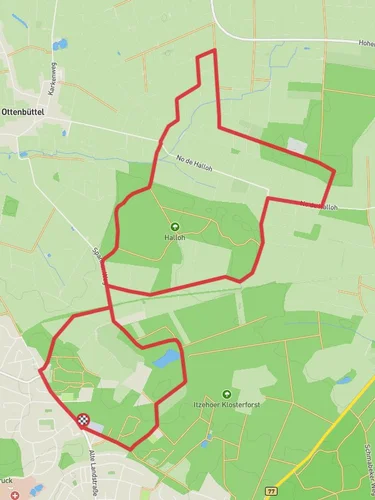
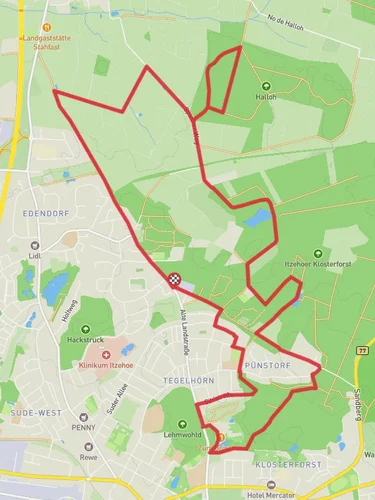
Starting near Kreis Steinburg, Germany, the Angelsee Heiligenstedten via Holzhofer Weg trail is a delightful 15 km (approximately 9.3 miles) loop with virtually no elevation gain, making it accessible for a wide range of hikers. The trail is rated as medium difficulty, primarily due to its length rather than any challenging terrain.
### Getting There To reach the trailhead, you can drive or use public transport. If driving, set your GPS to Kreis Steinburg, Germany. For those using public transport, take a train to Itzehoe station, which is the nearest major station. From Itzehoe, you can catch a local bus or taxi to Heiligenstedten, where the trail begins.
### Trail Overview The trail starts near the picturesque Angelsee (Angel Lake) in Heiligenstedten. This serene lake is a popular spot for fishing and offers a tranquil beginning to your hike. As you set off, you'll follow the Holzhofer Weg, a well-marked path that meanders through a mix of open fields and dense woodlands.
### Key Landmarks and Nature Around the 3 km (1.9 miles) mark, you'll come across the historic Heiligenstedten Church, a beautiful example of medieval architecture. This church dates back to the 12th century and is worth a brief stop to admire its intricate stonework and peaceful surroundings.
Continuing along the trail, you'll traverse through lush meadows and agricultural lands. Keep an eye out for local wildlife, including deer, foxes, and a variety of bird species. The area is particularly known for its rich birdlife, so bringing a pair of binoculars could enhance your experience.
### Navigation and Terrain The trail is well-marked, but it's always a good idea to have a reliable navigation tool. The HiiKER app is highly recommended for this purpose, as it provides detailed maps and real-time GPS tracking to ensure you stay on course.
### Historical Significance The region around Kreis Steinburg has a rich history, with settlements dating back to the early medieval period. The trail itself passes through areas that were once significant trade routes, and you may notice remnants of old pathways and boundary markers along the way.
### Practical Information The trail is mostly flat, with an elevation gain of around 0 meters (0 feet), making it suitable for hikers of all fitness levels. However, the length of the trail means you should be prepared with adequate water, snacks, and appropriate footwear. There are a few spots along the way where you can rest and enjoy a packed lunch, particularly near the lake and the church.
### Wildlife and Flora As you hike, you'll notice a variety of flora, including wildflowers, oak, and beech trees. The diverse plant life supports a healthy ecosystem, so be mindful of your surroundings and stick to the marked paths to preserve the natural habitat.
### Final Stretch The last few kilometers of the trail loop back towards Angelsee, offering a peaceful end to your hike. The lake's calm waters provide a perfect spot to relax and reflect on your journey before heading back to your starting point.
This trail offers a blend of natural beauty, historical landmarks, and a peaceful hiking experience, making it a rewarding adventure for those looking to explore the scenic landscapes of Kreis Steinburg.
Reviews
User comments, reviews and discussions about the Angelsee Heiligenstedten via Holzhofer Weg, Germany.
0.0
average rating out of 5
0 rating(s)


