11.5 km
~2 hrs 51 min
331 m
“Explore the Suedlicher Rothaarsteig and Kirchhundem trail: a 12 km loop of nature, history, and moderate challenge.”
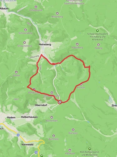
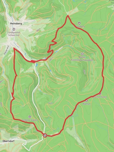
Starting near Kreis Olpe, Germany, the Suedlicher Rothaarsteig and Kirchhundem trail is a captivating 12 km (7.5 miles) loop with an elevation gain of approximately 300 meters (984 feet). This medium-difficulty trail offers a blend of natural beauty, historical significance, and a moderate challenge suitable for most hikers.
### Getting There To reach the trailhead, you can drive or use public transport. If driving, set your GPS to Kreis Olpe, Germany, and look for parking near the trailhead. For those using public transport, take a train or bus to the nearest station in Olpe, and from there, you can catch a local bus or taxi to the trailhead.
### Trail Navigation For navigation, it is highly recommended to use the HiiKER app, which provides detailed maps and real-time updates to ensure you stay on track.
### Trail Highlights
#### Nature and Wildlife The trail meanders through the lush forests of the Rothaargebirge, a mountain range known for its dense woodlands and diverse wildlife. As you hike, you'll encounter a variety of flora, including towering beech and oak trees. Keep an eye out for local wildlife such as deer, foxes, and a variety of bird species. The forest floor is often carpeted with ferns and wildflowers, adding a splash of color to your journey.
#### Elevation and Terrain The trail features a mix of gentle slopes and steeper inclines, with the most significant elevation gain occurring in the first half of the hike. The terrain is varied, ranging from well-maintained forest paths to rocky sections that require careful footing. The highest point of the trail offers panoramic views of the surrounding countryside, making the climb well worth the effort.
### Historical Significance The region around Kreis Olpe has a rich history dating back to medieval times. As you hike, you'll come across remnants of old settlements and possibly even ancient boundary stones that marked territories centuries ago. The area was also significant during the industrial revolution, with several old mining sites scattered throughout the forest. These historical landmarks provide a fascinating glimpse into the past and add an extra layer of interest to your hike.
### Points of Interest - Kirchhundem Village: Approximately halfway through the loop, you'll pass near the charming village of Kirchhundem. This is a great spot to take a break, explore the local architecture, and perhaps grab a bite to eat. - Scenic Overlook: Around the 8 km (5 miles) mark, there's a scenic overlook that offers breathtaking views of the Rothaargebirge. This is an ideal spot for photos and a rest before continuing your hike. - Old Mining Sites: Scattered along the trail, these sites are a testament to the region's industrial past. Informational plaques provide context and history, making these stops both educational and intriguing.
### Practical Tips - Footwear: Given the varied terrain, sturdy hiking boots are recommended. - Weather: The weather can be unpredictable, so bring layers and waterproof gear. - Water and Snacks: Ensure you carry enough water and snacks, especially if you plan to take your time exploring the historical sites and natural beauty.
This trail offers a well-rounded hiking experience, combining natural splendor, moderate physical challenge, and a touch of historical intrigue.
Reviews
User comments, reviews and discussions about the Suedlicher Rothaarsteig and Kirchhundem, Germany.
4.0
average rating out of 5
2 rating(s)


