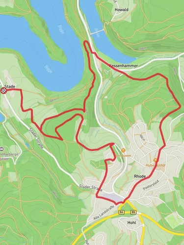
10.4 km
~2 hrs 34 min
295 m
“Explore the scenic and historic 10 km Rund um Attendorn loop, perfect for moderately experienced hikers.”
Starting near Kreis Olpe in Germany, this 10 km (6.2 miles) loop trail offers a delightful mix of natural beauty and historical intrigue. With an elevation gain of around 200 meters (656 feet), the Rund um Attendorn and Kurkoelner Weg is estimated to be of medium difficulty, making it suitable for moderately experienced hikers.
### Getting There
To reach the trailhead, you can drive or use public transport. If driving, set your GPS to Kreis Olpe, Germany. For those using public transport, take a train or bus to the Attendorn station, which is the nearest significant landmark. From there, it's a short walk to the trailhead.
### Trail Navigation
For navigation, it's highly recommended to use HiiKER, which provides detailed maps and real-time updates. This will ensure you stay on the correct path and can easily locate points of interest.
### Trail Highlights
#### Natural Beauty
The trail winds through a variety of landscapes, including dense forests, open meadows, and serene lakes. Early in the hike, you'll pass through a lush forest filled with oak and beech trees. As you ascend, the forest opens up to reveal panoramic views of the surrounding hills and valleys. Keep an eye out for local wildlife such as deer, foxes, and a variety of bird species.
#### Historical Significance
One of the most fascinating aspects of this trail is its historical significance. The Kurkoelner Weg is an ancient path that dates back to medieval times. It was once a crucial route for traders and pilgrims traveling through the region. Approximately 4 km (2.5 miles) into the hike, you'll come across the remnants of old stone markers that were used to guide travelers centuries ago.
#### Landmarks
Around the 6 km (3.7 miles) mark, you'll encounter the Biggesee, a large reservoir that offers stunning views and a perfect spot for a short break. The lake is not only a beautiful natural feature but also an important water source for the region. Continuing on, you'll pass by the Attendorn Cave, one of the largest and most impressive cave systems in Germany. While the cave itself is not part of the trail, it's worth noting its proximity for those interested in geology and natural history.
### Elevation and Terrain
The trail features a moderate elevation gain of 200 meters (656 feet), with the most significant ascent occurring in the first half of the hike. The terrain varies from well-maintained paths to more rugged sections, so sturdy hiking boots are recommended. There are a few steep sections, but they are manageable with a moderate level of fitness.
### Preparation
Given the medium difficulty rating, it's advisable to bring plenty of water, snacks, and a first-aid kit. Weather can be unpredictable, so pack layers and a waterproof jacket. The trail is well-marked, but having HiiKER on hand will provide extra assurance.
This trail offers a perfect blend of natural beauty, historical intrigue, and moderate physical challenge, making it a rewarding experience for any hiker.
Reviews
User comments, reviews and discussions about the Rund um Attendorn and Kurkoelner Weg, Germany.
5.0
average rating out of 5
2 rating(s)


