10.5 km
~2 hrs 32 min
262 m
“This 11 km loop near Kreis Euskirchen offers scenic beauty, historical landmarks, and moderate hiking challenges.”
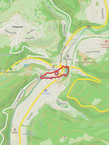
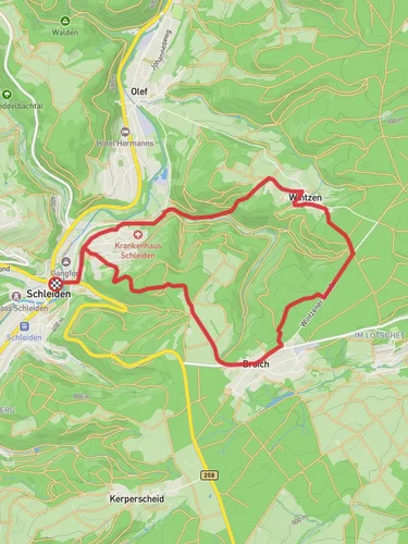
Starting near Kreis Euskirchen, Germany, the Reinzelbach, Elcher Bach, and Hahnensiefen trail is a picturesque loop spanning approximately 11 km (around 6.8 miles) with an elevation gain of about 200 meters (656 feet). This medium-difficulty trail offers a delightful mix of natural beauty, historical landmarks, and serene landscapes, making it a rewarding experience for hikers.
### Getting There To reach the trailhead, you can either drive or use public transport. If driving, set your GPS to Kreis Euskirchen, Germany, and look for parking options near the starting point. For those using public transport, take a train or bus to Euskirchen station. From there, local buses or a short taxi ride will get you to the trailhead.
### Trail Navigation For navigation, it's highly recommended to use HiiKER, which provides detailed maps and real-time updates to ensure you stay on track.
### Trail Highlights
#### Reinzelbach Stream The trail begins with a gentle ascent along the Reinzelbach stream. This section is lush with greenery, and the sound of flowing water adds a soothing backdrop to your hike. Keep an eye out for various bird species that frequent this area, making it a haven for birdwatchers.
#### Elcher Bach Valley Approximately 4 km (2.5 miles) into the hike, you'll enter the Elcher Bach Valley. This part of the trail is relatively flat and offers stunning views of the surrounding hills and forests. The valley is rich in flora, with wildflowers blooming in the spring and summer months. It's a great spot to take a break and enjoy a picnic.
#### Hahnensiefen Ridge As you approach the 7 km (4.3 miles) mark, the trail begins to ascend towards the Hahnensiefen Ridge. This section is the most challenging part of the hike, with a steady climb that rewards you with panoramic views of the Eifel region. The ridge is also home to various wildlife, including deer and foxes, so keep your camera ready.
### Historical Significance The region around Kreis Euskirchen has a rich history dating back to Roman times. Along the trail, you may come across remnants of old Roman roads and ancient boundary stones. These historical markers offer a glimpse into the past and add an educational element to your hike.
### Practical Information - Distance: 11 km (6.8 miles) - Elevation Gain: 200 meters (656 feet) - Difficulty: Medium - Trail Type: Loop
### Wildlife and Flora The trail is teeming with wildlife, including various bird species, deer, and foxes. The flora is equally diverse, with wildflowers, dense forests, and lush meadows. Spring and summer are the best times to experience the full bloom of the region's plant life.
### Safety Tips - Wear sturdy hiking boots, as some sections can be rocky and uneven. - Carry enough water and snacks, especially if you plan to take breaks along the way. - Check the weather forecast before heading out, as conditions can change rapidly. - Use HiiKER for real-time navigation and updates.
This trail offers a perfect blend of natural beauty, historical intrigue, and moderate physical challenge, making it an excellent choice for a day hike.
Reviews
User comments, reviews and discussions about the Reinzelbach, Elcher Bach and Hahnensiefen, Germany.
4.0
average rating out of 5
2 rating(s)


