Schwanenteich and Fuerstenlager via Alemannenweg and Camino Incluso
4.3 km
~1 hrs 3 min
125 m
“Explore a scenic 4 km loop in Germany blending natural beauty, historical landmarks, and moderate hiking challenges.”
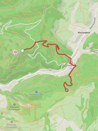
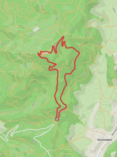
Starting near Kreis Bergstraße, Germany, this 4 km (approximately 2.5 miles) loop trail offers a delightful mix of natural beauty and historical significance. With an elevation gain of around 100 meters (328 feet), the trail is rated as medium difficulty, making it accessible for most hikers with a moderate level of fitness.
### Getting There To reach the trailhead, you can either drive or use public transport. If driving, set your GPS to Kreis Bergstraße, Germany, and look for parking options near the starting point. For those using public transport, take a train or bus to the nearest station in Bensheim, which is well-connected to major cities like Frankfurt and Heidelberg. From Bensheim, you can either take a local bus or a short taxi ride to the trailhead.
### Trail Overview The trail begins near the picturesque Schwanenteich, a serene pond that offers a perfect spot for a quick rest or a picnic before you start your hike. As you set off, you'll follow the Alemannenweg, a well-marked path that takes you through lush forests and open meadows. The trail is well-maintained, but it's always a good idea to have a navigation tool like HiiKER to ensure you stay on track.
### Significant Landmarks - Schwanenteich: This tranquil pond is home to various waterfowl, including swans and ducks. It's a great spot for bird-watching and photography. - Fuerstenlager: Approximately 2 km (1.2 miles) into the hike, you'll reach Fuerstenlager, a historical estate that dates back to the 18th century. The estate was once a summer residence for the nobility and features beautifully landscaped gardens, fountains, and classical architecture. Take some time to explore the grounds and perhaps visit the small museum that offers insights into the estate's history.
### Nature and Wildlife The trail winds through diverse landscapes, from dense forests to open fields. Keep an eye out for local wildlife such as deer, foxes, and various bird species. The flora is equally diverse, with a mix of deciduous and coniferous trees, wildflowers, and shrubs. Spring and autumn are particularly beautiful times to hike this trail, as the changing seasons bring vibrant colors and a variety of blooming plants.
### Elevation and Terrain The trail features a moderate elevation gain of around 100 meters (328 feet), with some gentle inclines and declines. The terrain is a mix of dirt paths, gravel, and occasional rocky sections. Good hiking shoes are recommended to navigate the varied surfaces comfortably.
### Historical Significance The Alemannenweg is named after the Alemanni, a group of Germanic tribes that settled in the region during the early Middle Ages. The trail passes through areas rich in history, including ancient settlements and medieval ruins. The Fuerstenlager estate itself is a testament to the region's aristocratic past, offering a glimpse into the lifestyle of the nobility in the 18th and 19th centuries.
### Practical Tips - Water and Snacks: There are limited facilities along the trail, so bring enough water and snacks to keep you energized. - Weather: Check the weather forecast before you go. The trail can be slippery after rain, so appropriate footwear is essential. - Navigation: While the trail is well-marked, using HiiKER can help you stay on course and provide additional information about points of interest along the way.
This trail offers a perfect blend of natural beauty, historical intrigue, and moderate physical challenge, making it a rewarding experience for hikers of all levels.
Reviews
User comments, reviews and discussions about the Schwanenteich and Fuerstenlager via Alemannenweg and Camino Incluso, Germany.
5.0
average rating out of 5
2 rating(s)


