11.1 km
~2 hrs 49 min
371 m
“Explore the serene Franconian landscape on the Traenksee via Traum Runde Castell trail, rich in history and nature.”
Starting your hike near Kitzingen, Germany, the Traenksee via Traum Runde Castell trail offers a delightful 11 km (approximately 6.8 miles) loop with an elevation gain of around 300 meters (984 feet). This medium-difficulty trail is perfect for those looking to immerse themselves in the serene beauty of the Franconian landscape.
### Getting There To reach the trailhead, you can drive or use public transport. If driving, set your GPS to Castell, a small town near Kitzingen. For public transport, take a train to Kitzingen and then a local bus to Castell. The trailhead is conveniently located near the town center, making it easily accessible.
### Trail Overview The trail begins in the picturesque town of Castell, known for its historical significance and charming architecture. As you start your hike, you'll pass through the town's cobblestone streets, offering a glimpse into its rich history dating back to the Middle Ages. Castell is renowned for its wine production, so you might even catch a whiff of fermenting grapes if you're hiking during the harvest season.
### Nature and Wildlife As you leave the town, the trail meanders through lush forests and open meadows. Keep an eye out for local wildlife such as deer, foxes, and a variety of bird species. The trail is well-marked, but it's always a good idea to have a navigation tool like HiiKER to ensure you stay on track.
### Significant Landmarks Around the 3 km (1.86 miles) mark, you'll come across the Traenksee, a tranquil lake that offers a perfect spot for a short break. The lake is surrounded by dense forest, providing a serene atmosphere to relax and enjoy the natural beauty.
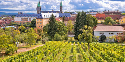
Continuing on, you'll encounter several historical landmarks, including ancient ruins and old farmhouses that tell the story of the region's agricultural past. The trail also offers panoramic views of the surrounding vineyards, especially as you gain elevation.
### Elevation and Terrain The trail's elevation gain of 300 meters (984 feet) is spread out over the 11 km (6.8 miles), making it a manageable climb for most hikers. The terrain varies from forest paths to open fields, with some rocky sections that require careful footing. Good hiking boots are recommended to navigate these areas comfortably.
### Final Stretch As you loop back towards Castell, the trail descends gently, offering more stunning views of the Franconian countryside. The final stretch takes you through more vineyards, where you might even spot local farmers tending to their crops.
### Practical Tips - Water and Snacks: There are no facilities along the trail, so bring enough water and snacks to keep you energized. - Weather: Check the weather forecast before you go. The trail can be muddy after rain, making some sections slippery. - Wildlife: Be respectful of the local wildlife. Keep a safe distance and avoid feeding any animals you encounter.
This trail offers a perfect blend of natural beauty, historical landmarks, and moderate physical challenge, making it a rewarding experience for any hiker.
Reviews
User comments, reviews and discussions about the Traenksee via Traum Runde Castell, Germany.
4.0
average rating out of 5
3 rating(s)


