7.6 km
~1 hrs 42 min
117 m
“Experience a rewarding hike through serene lakes, lush forests, and historic ruins in Kaufbeuren's scenic loop trail.”
Starting near Kaufbeuren, Germany, the Bachtelsee and Freyberg Loop via Barensee is an 8 km (approximately 5 miles) loop trail with an elevation gain of around 100 meters (328 feet). This medium-difficulty trail offers a blend of natural beauty, historical landmarks, and serene landscapes, making it a rewarding experience for hikers.
### Getting There To reach the trailhead, you can drive or use public transport. If driving, set your GPS to Kaufbeuren, and look for parking near the Bachtelsee area. For those using public transport, take a train to Kaufbeuren station. From there, local buses or a short taxi ride can get you to the trailhead.
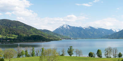
### Trail Overview The trail begins near the picturesque Bachtelsee, a small lake that offers a tranquil start to your hike. As you set off, you'll be surrounded by lush greenery and the gentle sounds of nature. The path is well-marked, but it's always a good idea to have the HiiKER app for navigation.
### Key Landmarks and Sections
#### Bachtelsee to Barensee The first section of the trail takes you from Bachtelsee to Barensee, covering approximately 3 km (1.9 miles). This part of the hike is relatively flat, making it a good warm-up. Along the way, you'll pass through dense forests and open meadows, offering a variety of flora and fauna. Keep an eye out for deer and various bird species that inhabit the area.
#### Barensee to Freyberg As you approach Barensee, the trail begins to ascend slightly, gaining about 50 meters (164 feet) in elevation over the next 2 km (1.2 miles). Barensee itself is another serene lake, perfect for a short break. From here, the trail continues towards Freyberg, where you'll encounter more historical elements.
#### Historical Significance Freyberg is home to the ruins of Freyberg Castle, a medieval fortress that dates back to the 12th century. The ruins are a significant landmark and offer a glimpse into the region's rich history. Take some time to explore the ruins and enjoy the panoramic views of the surrounding countryside.
### Final Stretch: Freyberg to Bachtelsee The final 3 km (1.9 miles) of the loop take you back to Bachtelsee. This section is mostly downhill, making for a pleasant and easy finish to your hike. The trail winds through more forested areas and meadows, providing a peaceful end to your journey.
### Wildlife and Nature Throughout the hike, you'll be immersed in the natural beauty of the region. The forests are home to a variety of wildlife, including deer, foxes, and numerous bird species. The lakes, Bachtelsee and Barensee, are also teeming with aquatic life and are great spots for birdwatching.
### Preparation and Tips Given the medium difficulty rating, it's advisable to wear sturdy hiking boots and bring plenty of water. The trail is well-maintained, but weather conditions can affect the terrain, so check the forecast before heading out. Using the HiiKER app will ensure you stay on track and can easily navigate any tricky sections.
This loop trail offers a perfect blend of natural beauty, historical intrigue, and moderate physical challenge, making it a must-visit for hikers in the Kaufbeuren area.
Reviews
User comments, reviews and discussions about the Bachtelsee and Freyberg Loop via Barensee, Germany.
5.0
average rating out of 5
6 rating(s)


