6.7 km
~1 hrs 38 min
185 m
“Explore lush forests and historic landmarks on the invigorating 7-km Herzberg via Taunusklub Route.”
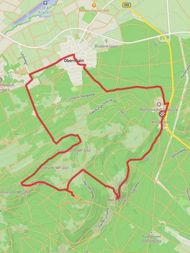
Starting near Hochtaunuskreis, Germany, the Herzberg via Taunusklub Route is an invigorating out-and-back trail that spans approximately 7 kilometers (4.35 miles) with an elevation gain of around 100 meters (328 feet). This trail is rated as medium difficulty, making it suitable for hikers with a moderate level of fitness.
### Getting There To reach the trailhead, you can either drive or use public transport. If you're driving, set your GPS to Hochtaunuskreis, Germany, and look for parking near the starting point. For those using public transport, take a train or bus to the nearest station in Hochtaunuskreis and then follow local signage or use HiiKER for precise navigation to the trailhead.
### Trail Overview The Herzberg via Taunusklub Route offers a delightful mix of natural beauty and historical significance. As you begin your hike, you'll find yourself surrounded by the lush greenery of the Taunus forest. The trail is well-marked, but it's always a good idea to have HiiKER on hand for real-time navigation and updates.
### Significant Landmarks and Nature Around the 2-kilometer (1.24-mile) mark, you'll come across the first significant landmark: the Herzberg Tower. This historic tower offers panoramic views of the surrounding Taunus region and is a great spot for a short break. The tower itself has a rich history, dating back to the early 20th century, and serves as a reminder of the area's cultural heritage.
Continuing on, the trail meanders through dense forests and open meadows, providing ample opportunities to spot local wildlife such as deer, foxes, and a variety of bird species. The flora is equally diverse, with towering beech and oak trees creating a canopy overhead, and seasonal wildflowers adding splashes of color to the forest floor.
### Elevation and Terrain The elevation gain is gradual, making the ascent manageable for most hikers. The trail's highest point is near the Herzberg Tower, at approximately 500 meters (1,640 feet) above sea level. The terrain is a mix of dirt paths and rocky sections, so sturdy hiking boots are recommended.
### Historical Significance The Taunus region has a storied past, with evidence of human settlement dating back to the Roman era. As you hike, you'll pass by remnants of ancient fortifications and old stone walls, offering a glimpse into the area's historical significance. The Herzberg Tower itself is a testament to the region's rich history, having served various purposes over the decades, from a lookout point to a tourist attraction.
### Final Stretch As you make your way back to the trailhead, take a moment to appreciate the serene beauty of the Taunus forest. The return journey offers a different perspective, with the changing light and shadows creating a dynamic landscape that is ever-changing and always captivating.
Whether you're a seasoned hiker or a nature enthusiast, the Herzberg via Taunusklub Route provides a rewarding experience that combines natural beauty, historical landmarks, and a moderate physical challenge.
Reviews
User comments, reviews and discussions about the Herzberg via Taunusklub Route, Germany.
5.0
average rating out of 5
4 rating(s)


