7.8 km
~2 hrs 7 min
338 m
“Explore the scenic 8 km Ersteberg loop in Thuringian Forest, blending natural beauty and historical intrigue.”
Starting near the charming town of Hildburghausen in Germany, the Ersteberg via Giessuebler Schweiz trail offers an 8 km (5 miles) loop with an elevation gain of approximately 300 meters (984 feet). This medium-difficulty hike is perfect for those looking to explore the Thuringian Forest's natural beauty and historical significance.
### Getting There To reach the trailhead, you can drive or use public transport. If driving, head towards Hildburghausen and park near the town center. For public transport, take a train to Hildburghausen station, which is well-connected to major cities like Erfurt and Nuremberg. From the station, it's a short walk to the trailhead.
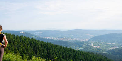
### Trail Overview The trail begins near the town center of Hildburghausen, making its way through lush forests and open meadows. The initial section is relatively flat, allowing you to ease into the hike. As you progress, the trail starts to ascend gradually, offering panoramic views of the surrounding countryside.
### Key Landmarks and Points of Interest - Giessuebler Schweiz: Around the 2 km (1.2 miles) mark, you'll encounter the Giessuebler Schweiz, a picturesque area known for its unique rock formations and dense forest. This section is particularly scenic and offers excellent photo opportunities. - Ersteberg Summit: At approximately 4 km (2.5 miles), you'll reach the summit of Ersteberg. Standing at 720 meters (2,362 feet) above sea level, the summit provides breathtaking views of the Thuringian Forest. It's a great spot to take a break and enjoy a packed lunch. - Historical Significance: The region around Hildburghausen has a rich history dating back to the medieval period. Keep an eye out for old stone markers and remnants of ancient settlements along the trail. The area was also significant during the Napoleonic Wars, adding a layer of historical intrigue to your hike.
### Flora and Fauna The Thuringian Forest is home to a diverse range of flora and fauna. As you hike, you'll pass through dense beech and spruce forests, interspersed with open meadows teeming with wildflowers. Wildlife enthusiasts might spot deer, foxes, and a variety of bird species, including woodpeckers and owls.
### Navigation and Safety Given the trail's moderate difficulty, it's advisable to use a reliable navigation tool like HiiKER to stay on track. The trail is well-marked, but having a digital map can be reassuring, especially in the denser forest sections. Wear sturdy hiking boots and bring plenty of water, as the elevation gain can be challenging, particularly in warmer weather.
### Final Stretch The descent from Ersteberg is gradual, taking you through more forested areas and eventually looping back towards Hildburghausen. The final 2 km (1.2 miles) are relatively easy, allowing you to cool down as you make your way back to the trailhead.
This hike offers a perfect blend of natural beauty, historical significance, and moderate physical challenge, making it a rewarding experience for any outdoor enthusiast.
Reviews
User comments, reviews and discussions about the Ersteberg via Giessuebler Schweiz, Germany.
4.0
average rating out of 5
4 rating(s)


