11.9 km
~2 hrs 43 min
209 m
“Explore a scenic 12 km trail near Heilbronn, blending lush landscapes with rich historical intrigue.”
Nestled near the charming city of Heilbronn, Germany, this loop trail offers a delightful blend of natural beauty and cultural history. Spanning approximately 12 kilometers (about 7.5 miles) with an elevation gain of around 200 meters (approximately 656 feet), this trail is rated as medium difficulty, making it suitable for moderately experienced hikers.
### Getting There
To reach the trailhead, which is conveniently located near Heilbronn, you can opt for either public transport or a car. If you're traveling by train, Heilbronn Hauptbahnhof is the nearest major station. From there, local buses can take you closer to the trailhead. Alternatively, if you're driving, parking is available at the Parkplatz Wanderweg, which serves as a convenient starting point for your adventure.
### Trail Highlights
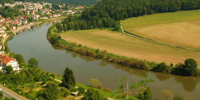
As you embark on this loop trail, you'll be greeted by a diverse landscape that showcases the region's natural beauty. The trail meanders through lush forests, open meadows, and alongside the serene Mühlbach stream. The gentle sound of flowing water accompanies you for a portion of the hike, providing a soothing backdrop to your journey.
### Flora and Fauna
The trail is a haven for nature enthusiasts, with a rich variety of flora and fauna. Depending on the season, you might encounter vibrant wildflowers, towering oak and beech trees, and a variety of bird species. Keep an eye out for deer and other small mammals that inhabit the area. The biodiversity here is a testament to the region's well-preserved natural environment.
### Historical Significance
This area is steeped in history, with remnants of past settlements and agricultural practices visible along the trail. The region around Heilbronn has been inhabited since Roman times, and you may come across historical markers or ruins that hint at its storied past. These landmarks offer a glimpse into the lives of those who once called this area home.
### Navigation and Safety
For navigation, the HiiKER app is an excellent tool to ensure you stay on track. The trail is well-marked, but having a digital map can provide additional peace of mind. As with any hike, it's important to wear appropriate footwear and carry sufficient water, especially during warmer months. The trail's moderate difficulty means there are some inclines, but they are manageable for most hikers with a reasonable level of fitness.
### Final Stretch
As you near the end of the loop, the trail gently descends back towards the Parkplatz Wanderweg, offering a satisfying conclusion to your hike. The combination of natural beauty, historical intrigue, and the gentle challenge of the terrain makes this trail a rewarding experience for those exploring the Heilbronn region.
Reviews
User comments, reviews and discussions about the Mühlbach via Parkplatz Wanderweg and Verbindungsweg, Germany.
5.0
average rating out of 5
3 rating(s)


