6.1 km
~1 hrs 17 min
40 m
“This 6 km loop trail near Grafschaft Bentheim blends lush landscapes and rich history, ideal for prepared hikers.”
Starting near Grafschaft Bentheim, Germany, this 6 km (approximately 3.7 miles) loop trail offers a delightful mix of natural beauty and historical significance. With no significant elevation gain, this trail is accessible to a wide range of hikers, though it is rated as medium difficulty due to some uneven terrain and potentially muddy sections.
### Getting There To reach the trailhead, you can drive or use public transport. If driving, set your GPS to Grafschaft Bentheim, a well-known town in Lower Saxony. There are parking facilities available near the start of the trail. For those using public transport, take a train to Bad Bentheim station, which is well-connected to major cities like Osnabrück and Münster. From the station, you can catch a local bus or taxi to the trailhead.
### Trail Navigation For navigation, it is highly recommended to use the HiiKER app, which provides detailed maps and real-time updates. This will help you stay on track and make the most of your hiking experience.
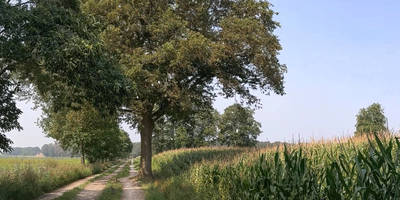
### Trail Highlights The trail begins near the picturesque town of Grafschaft Bentheim, known for its medieval castle, Bentheim Castle, which dates back to the 11th century. As you start your hike, you'll be greeted by lush green meadows and dense woodlands, offering a serene escape from urban life.
#### Bramberg About 2 km (1.2 miles) into the hike, you'll reach Bramberg, a small hill that provides a panoramic view of the surrounding countryside. Although the elevation gain is minimal, the vantage point offers a unique perspective of the region's natural beauty. Keep an eye out for local wildlife, including deer and various bird species that inhabit the area.
#### Kleiner Muehlenteich Continuing on, you'll come across Kleiner Muehlenteich, a charming small pond located roughly 4 km (2.5 miles) into the trail. This is an excellent spot for a short break, where you can enjoy the tranquil waters and perhaps spot some ducks or other waterfowl. The pond is surrounded by a mix of deciduous and coniferous trees, making it a perfect spot for nature photography.
### Historical Significance The region around Grafschaft Bentheim has a rich history, with evidence of human settlement dating back to the Bronze Age. The trail itself follows part of the Noaberpad, a long-distance hiking route that connects the Netherlands and Germany, symbolizing the historical ties and peaceful coexistence between the two countries. Along the way, you may encounter old boundary stones and markers that tell the story of the region's past.
### Practical Tips - Footwear: Given the potential for muddy sections, especially after rain, waterproof hiking boots are recommended. - Weather: Check the weather forecast before you go. The trail can be slippery in wet conditions. - Supplies: Bring enough water and snacks, as there are no facilities along the trail. - Wildlife: While the area is generally safe, always be respectful of wildlife and maintain a safe distance.
This trail offers a perfect blend of natural beauty and historical intrigue, making it a rewarding experience for any hiker.
Reviews
User comments, reviews and discussions about the Bramberg and Kleiner Muehlenteich via Noaberpad, Germany.
4.0
average rating out of 5
3 rating(s)


