9.8 km
~2 hrs 42 min
442 m
“Explore Swabian Jura's natural beauty and Celtic history on the scenic Unterlenningen to Heidengraben trail.”
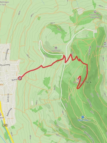
Starting near the charming town of Esslingen, Germany, the Unterlenningen to Heidengraben via Eibereschweg trail offers a delightful 10 km (6.2 miles) journey through the Swabian Jura. With an elevation gain of approximately 400 meters (1,312 feet), this point-to-point trail is rated as medium difficulty, making it suitable for moderately experienced hikers.
### Getting There To reach the trailhead, you can take a train to the Unterlenningen station from Esslingen, which is well-connected by regional trains. If you prefer to drive, there are parking facilities available near the station. The trailhead is conveniently located near the Unterlenningen train station, making it accessible for both public transport users and drivers.
### Trail Overview The trail begins in Unterlenningen, a picturesque village known for its traditional Swabian architecture. As you set off, you'll be greeted by lush forests and rolling hills. The initial part of the trail is relatively gentle, allowing you to ease into the hike.
### Key Landmarks and Nature Around the 2 km (1.2 miles) mark, you'll encounter the Eibereschweg, a scenic path that winds through dense woodlands. This section is particularly beautiful in the spring and autumn when the foliage is vibrant. Keep an eye out for local wildlife such as deer and various bird species.
As you continue, the trail gradually ascends, offering panoramic views of the surrounding countryside. At approximately 5 km (3.1 miles), you'll reach a viewpoint that provides a stunning vista of the Swabian Jura. This is a great spot to take a break and enjoy the scenery.
### Historical Significance One of the highlights of this trail is the Heidengraben, an ancient Celtic fortification dating back to the Iron Age. Located around the 8 km (5 miles) mark, the Heidengraben is one of the largest and best-preserved Celtic oppida in Europe. The site includes remnants of walls and ditches, offering a fascinating glimpse into the region's history. Informational plaques provide context and details about the significance of the site.
### Final Stretch The final 2 km (1.2 miles) of the trail descend gently towards the endpoint. The path meanders through open fields and small patches of forest, eventually leading you to the village of Grabenstetten. Here, you can catch a bus back to Esslingen or arrange for a pick-up if you drove to the trailhead.
### Navigation and Safety For navigation, it's highly recommended to use the HiiKER app, which provides detailed maps and real-time updates. The trail is well-marked, but having a reliable navigation tool ensures you stay on track. Make sure to carry enough water, wear sturdy hiking boots, and check the weather forecast before setting out.
This trail offers a perfect blend of natural beauty, moderate physical challenge, and historical intrigue, making it a rewarding experience for any hiker.
Reviews
User comments, reviews and discussions about the Unterlenningen to Heidengraben via Eibereschweg, Germany.
0.0
average rating out of 5
0 rating(s)


