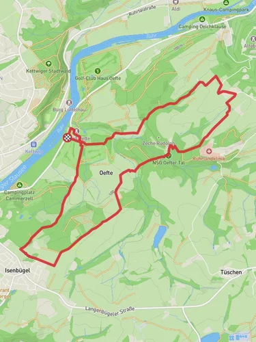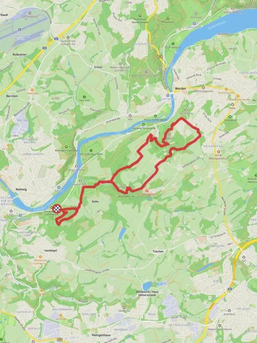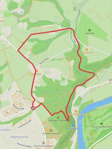
13.1 km
~3 hrs 2 min
255 m
“"Explore a scenic 13 km loop near Essen blending natural beauty, historical landmarks, and moderate hiking challenges."”
Starting near Essen, Germany, this 13 km (approximately 8 miles) loop trail offers a delightful mix of natural beauty and historical significance. With an elevation gain of around 200 meters (656 feet), it is rated as a medium difficulty hike, making it suitable for moderately experienced hikers.
### Getting There To reach the trailhead, you can either drive or use public transport. If driving, you can park near the Baldeneysee Lake, which is a well-known landmark in the area. For those using public transport, take the S-Bahn to Essen-Hügel station, which is conveniently close to the starting point.
### Trail Overview The trail begins near the picturesque Baldeneysee Lake, a popular spot for both locals and tourists. As you set off, you'll be greeted by the serene waters and lush greenery that surround the lake. The first section of the trail takes you through the Ruhrtalblick, offering stunning views of the Ruhr Valley. This part of the trail is relatively flat, making it a good warm-up for the more challenging sections ahead.
### Ruhrtalblick to Ruthertal Approximately 3 km (1.9 miles) into the hike, you'll start to ascend towards the Ruhrtalblick viewpoint. The elevation gain here is gradual, but you'll notice the change in terrain as you climb. The viewpoint offers panoramic views of the Ruhr Valley, a perfect spot for a short break and some photography.
Continuing on, you'll enter the Ruthertal, a lush valley filled with diverse flora and fauna. This section is particularly beautiful in the spring and summer months when the wildflowers are in full bloom. Keep an eye out for local wildlife, including deer and various bird species. The trail here is well-marked, but it's always a good idea to have a navigation tool like HiiKER to ensure you stay on track.
### Ruthertal to Leinpfad Around the 7 km (4.3 miles) mark, you'll transition from the Ruthertal to the Leinpfad. This part of the trail runs parallel to the Ruhr River, offering a different perspective of the landscape. The path here is relatively flat and easy to navigate, making it a good opportunity to pick up the pace if you're looking to cover more ground quickly.
### Historical Significance As you hike along the Leinpfad, you'll come across several historical landmarks. One notable site is the Villa Hügel, the former residence of the Krupp family, who were prominent industrialists in the 19th and 20th centuries. The villa is now a museum and offers a fascinating glimpse into the region's industrial history. Another point of interest is the Baldeney Castle ruins, which date back to the medieval period. These ruins are a reminder of the area's long and storied past.
### Final Stretch The last few kilometers of the trail take you back towards Baldeneysee Lake. This section is relatively easy, with a gentle descent that brings you back to the starting point. As you approach the end of the hike, you'll have another opportunity to enjoy the scenic views of the lake and perhaps even spot some local waterfowl.
### Practical Tips - Wear sturdy hiking boots, as some sections of the trail can be rocky and uneven. - Bring plenty of water and snacks, especially if you plan to take breaks at the various viewpoints. - Check the weather forecast before you go, as the trail can be slippery in wet conditions. - Use HiiKER for navigation to ensure you stay on the correct path and make the most of your hike.
This trail offers a wonderful blend of natural beauty, historical landmarks, and moderate physical challenge, making it a rewarding experience for any hiker.
Reviews
User comments, reviews and discussions about the Springer Teich via Ruhrtalblick, Ruthertal and Leinpfad, Germany.
5.0
average rating out of 5
6 rating(s)


